MapPornのTwitterイラスト検索結果。 313 件中 8ページ目

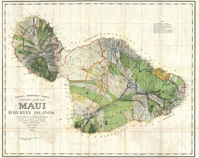
1885 Map of Maui, #Hawaii by Alexander De Witt https://t.co/siKkuuUZ44 #MapPorn


A Map of the Myriad Countries of the World (坤輿萬國全圖), The First Chinese World Map (Japanese copy, 1604) https://t.co/3eHcsGMKxF #MapPorn


Exclusive Economic Zones in the Pacific Ocean https://t.co/tXgc9oyGFS #MapPorn

Toponymic map of Great #Britain by Steven Kay @stevefaeembra https://t.co/pWxQpuZdwc #MapPorn

Shaded relief map of Martinique, an island in the #Caribbean Sea, technically part of France. https://t.co/rOWuRthg5D #MapPorn

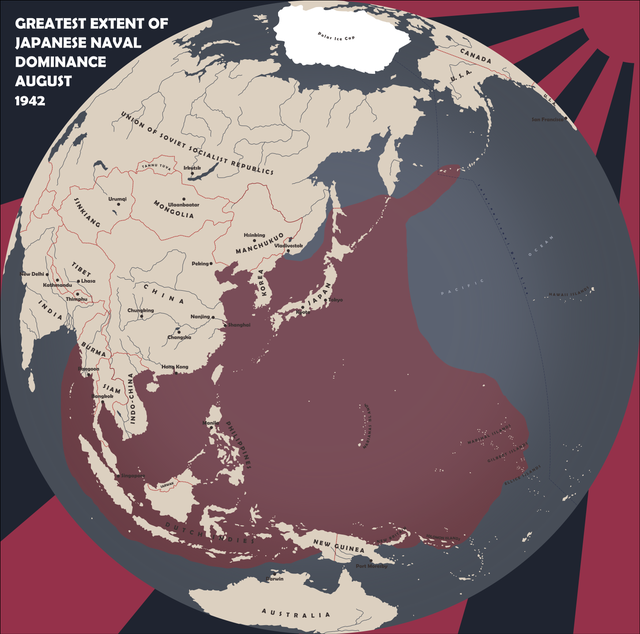
Greatest Extent of Japanese Naval Dominance: August 1942 https://t.co/w1QPBI932G #MapPorn
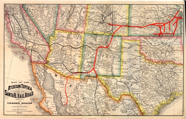
Map of the Atchison, Topeka and Santa Fe Railroad Company and its leased roads and connections (c1881) https://t.co/DBAGPOkobl #MapPorn

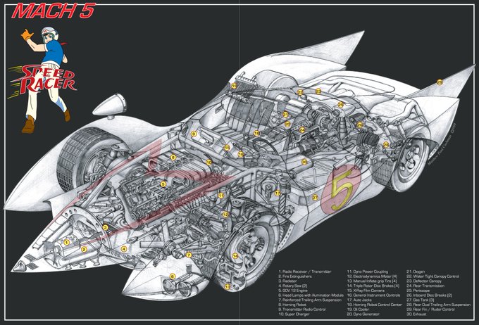
The Speed Racer MACH 5 by Matthew Cushman https://t.co/7u9Brcn1OZ #MapPorn

Eye of Sauron Viewshed Analysis by Andy Siegel https://t.co/1d0DvYywpY #MapPorn
