TopographyのTwitterイラスト検索結果。 553 件中 28ページ目


still not the best topography but holy damn is it better than before


World of Dimentiara by Kalium
"These are some maps that I made a couple of years ago on commission for a webcomic author of his world. He provided the basic landforms, and it was up to me to make some maps with topography and biome placement."
https://t.co/kSX1iQ7zEm


Self-Determination, 9.25”x12.5”, ink on paper. 5/365 🎨✍️#arteveryday #drawing #inkonpaper #inkdrawing #abstract #topography #art #VictoriaBoardmanStudio


Are topographical #views reliable evidence, or a form of #FakeNews exploited by many - patron, artist, printmaker, publisher, author? Transforming Topography @britishlibrary https://t.co/7u2wHRyzNM

Swedish artist Elias Martin (1739–1818) in his Soho studio. #Drawing @NatMus_SWE , explored @britishlibrary by Mikael Ahlund: Topography, iron-making and national identity in the 18th century – A British–Swedish comparison https://t.co/9nOIWo4ihk


Topography: Interview with Paul Glabicki #Art #Photography #Pt2 https://t.co/6vy5JsWMPz


Le millésime 2016 des Desktopography est sorti, votre prochain fond d'écran se trouve peut-être ici 💙 https://t.co/qZlMqce7Fs


"Vivid Nature" by @_onefix #digitalart ======> @_onefix:— Vivid Nature for #desktopography 2014-2015. Make your #mo…


Desktopography 2015 Wallpaper Exhibition. http://t.co/S9e6hddRFs - Beautiful. Free!


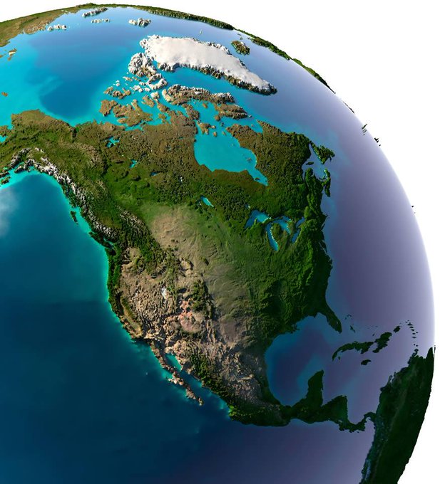
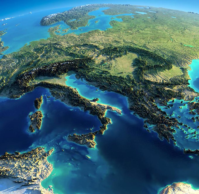
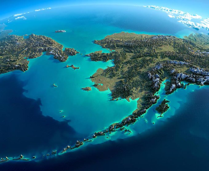
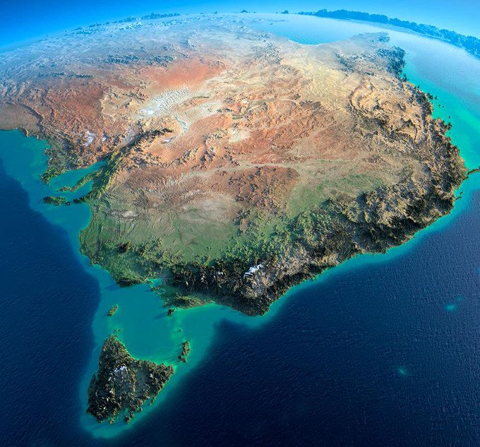
terrain elevation models by Anton Balazh to puts the Earth's land topography into perspective.. wow


i think my brain came through tonight afterall, l'inspiration & final #graphicdesign #student #photoshop #topography