OpenStreetMapのTwitterイラスト検索結果。 29 件中 2ページ目


Recherches d'autres stimulants pour affiner encore #OpenStreetMap : il y a des endroits qui frisent la "surqualité" Ici, zoom sur la zone éco au sud d'Orange : les détails sont poussés du bâti à la voirie en passant par les espaces naturels. https://t.co/Zq0pTVUCXv #OSMquality

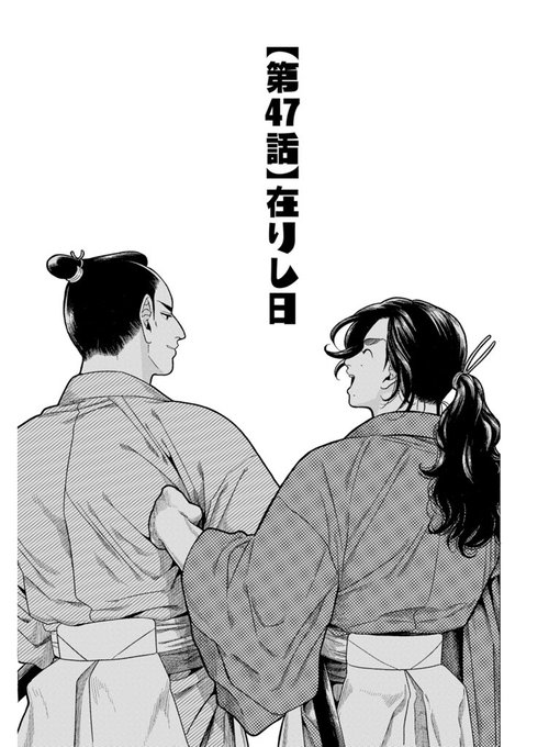

サムライせんせい最新話『在りし日』更新されました
武市先生、竜馬の江戸の思い出
お読み頂けると幸いです🤲
https://t.co/xF6Hn32mCJ
地図は©OpenStreetMap contributorsよりhttps://t.co/NYxR62SYR7


#podcastoftheday
Listen to Andy Allan (@gravitystorm), cartographer and the creator of OpenCycleMap as the talks about how he got involved with the OpenStreetMap project and ended up creating activity-specific maps at a global scale
https://t.co/yXErgf1NCs


La @NantesDigitalW c'est presque fini mais ce week-end à #Nantes il y a aussi les #JEP2019 !
Venez conjuguer #patrimoine et #numerique avec la promenade #OpenStreetMap, en accès libre, à 14 h ou l'atelier-rencontre à 15 h.
https://t.co/vuXCtXjqsG
@StephanePajot44 @JEP @nantesfr


Within days of the Brumadinho dam disaster, OpenStreetMap contributors were able to use Sentinel-2 imagery to produce a detailed outline of the mudflow: https://t.co/UqGciTXs2N as highlighted on this map created to illustrate the wikipedia article: https://t.co/KplOvrSVN1


New Project: Flights to Rome #flights2rome. A data visualization of the entire global 🚗 and ✈️ mobility network.
→ https://t.co/c5pYhfHD7q
w/ @st_phan @moovelLab @HerwigScherabon @whatsuprapha @tibbb Data: @flightradar24 and #OpenStreetMap


Tsurugajo castle park 360 photomapping completed. Map: Chiriintizu, App: Kashmir #OpenStreetMap #SotM

