Amazed at the different scales being seen in #Epsilon. Zoomed-in, this might look like a hurricane you would see at 15N, 50W in August. Then you zoom out, and you see it's embedded in a moist bubble in a massive upper-level trough.
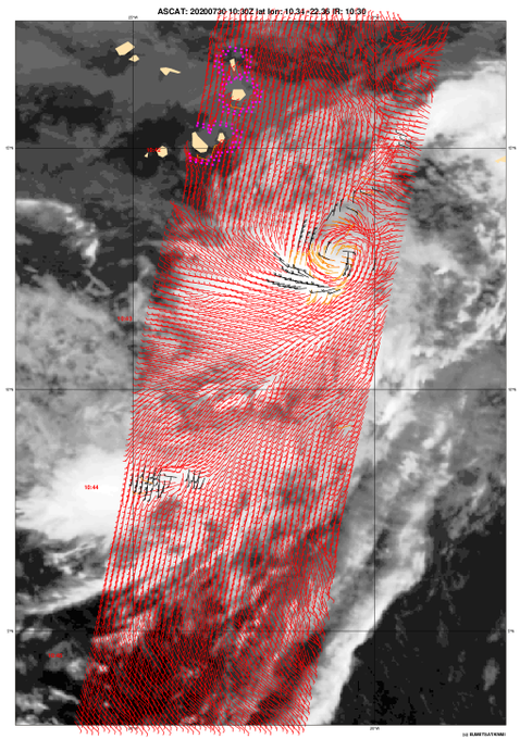
As a couple other mentioned, this wave to the SE of the Cabo Verde islands honestly looks like it could be very close to being a TD already. Convection has been asymmetric but persistent, and ASCAT shows a solid circulation with 30kt winds. Will be short-lived whatever it is.
Another sign of how the global tropical SST trends (+AMO, -ENSO) is favoring a potentially busy hurricane season: the "MDR-global tropics" SSTA difference is positive for the first time this season. We'll see how that persists with Atlantic trades forecast to pick up.


