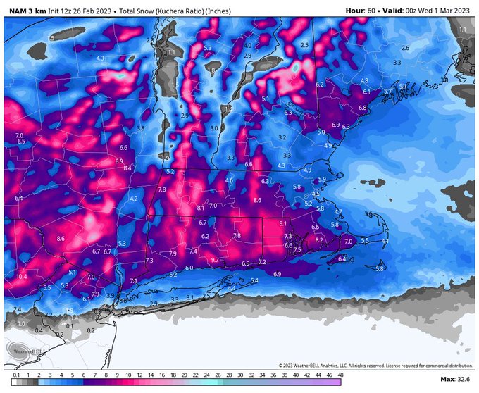
Here’s the 06z NAM L. 12z R even more amped. I took the Kuchera to dial back what it was showing south. Likely a touch overdone… not seeing any justification yet to increase amounts.
What a phenomenal capture of the #falcon9 @SpaceX #rocket #launch 🚀 from the Thimble Islands!
📷:Heather Ziac
When you seeweather, #eweather!
This is only the first part…the new HREF ensemble mean rainfall outputs are ugly! If you haven’t seen much rain yet, lots of time left.
New 12z HRRR continues the same general idea. Heavy rain coming. Still TBD who sees the most. But localized amounts over 5” quite possible. Notice the sharp cutoff east.
The 00z HREF ensemble total precipitation is a big time signal for heavy rain. Always tough to pinpoint who gets the most, but some localized areas will likely see 3 to 5”
A soaker tomorrow into Tuesday. Stalled front. Periods of rain, some heavy. The timing for the heaviest and most widespread rainfall looks to be later tomorrow into early Tues. 1-2” with locally higher amounts. Less SE.
I mean really? Here’s the Euro Kuchera. Usually only the NAM does stuff like this.
This is NOT forecast - its overdoing the ratios…but still…I’m getting a feeling this one may be insane. https://t.co/Ks2hfj8sbo
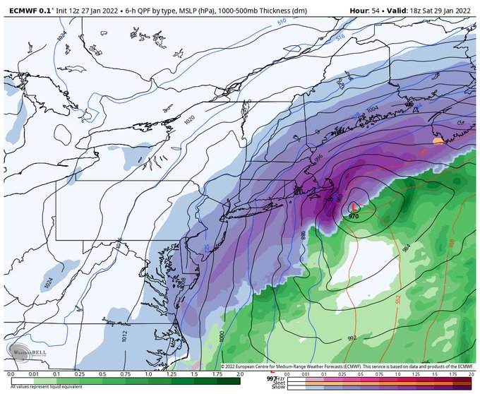
12z Euro doubling down against the GFS. Ticks west. A major blizzard across eastern areas. 10:1 ratios shown. Wow.


