
World Climate Serviceさんのイラストまとめ
@WorldClimateSvcFollow @WorldClimateSvcさんをフォローする
フォロー数:1036 フォロワー数:9690

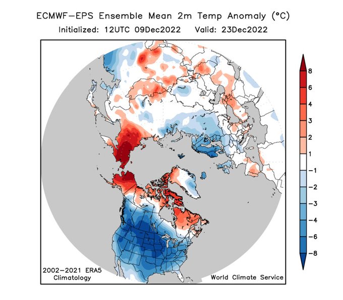

Coast-to-coast U.S. cold leading up to Christmas: an extremely impressive ECMWF ensemble-mean signal at day 14. Big shift towards prolonged -AO blocking in the 12Z run today. Wow!
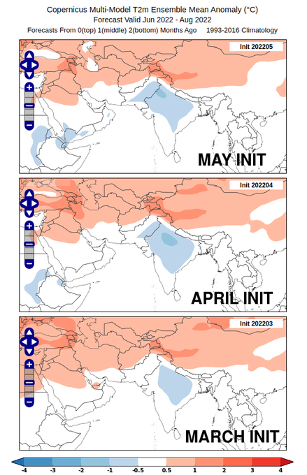
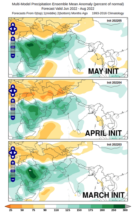
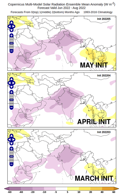
Relief will arrive eventually for N India and Pakistan: the seasonal models point to an unusually cool, wet, and cloudy #monsoon season ahead. (Last year's forecast was similar, but the signals are much stronger this year). Monsoon rains still some weeks off, however.
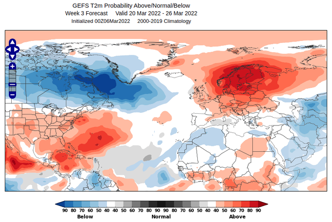
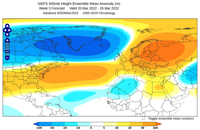
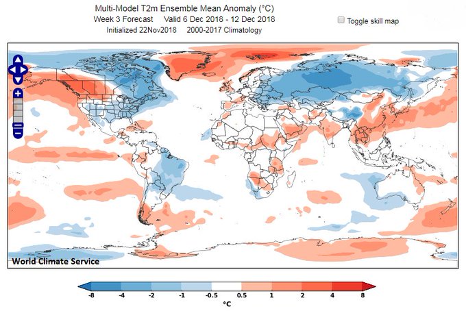
The latest 35-day GEFS shows a very strong warm signal over N Europe for week 3: 80-90% chance of significantly above-normal temps for most of Scandinavia. It's rare to see such a strong signal in these calibrated (reliable) probabilities at week 3 -> higher confidence than usual
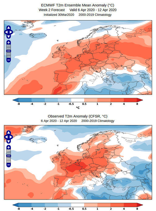
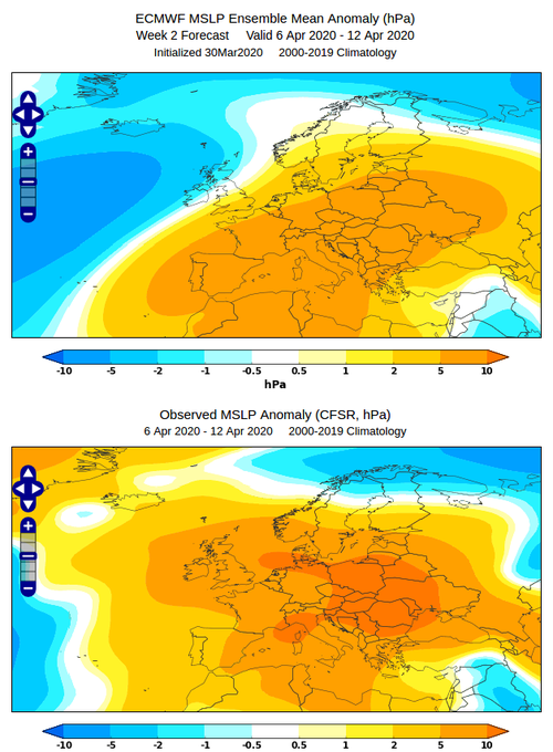
@weather_king Remarkable! Interestingly the temperature forecast was really quite good, but for the wrong reason, as the MSLP pattern was profoundly different near the British Isles

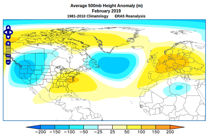
NASA's latest seasonal forecast for January-March looks remarkably similar to last February's pattern from the US to Europe - and that was a month to remember (record cold in the western US, 20°C in the UK)


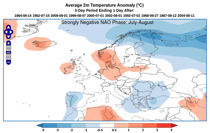

Yesterday's daily NAO (EOF) index of -2.0 was the lowest so far this summer, and lowest since the March 2018 #BeastfromtheEast. As noted by @TimWoollings today there are big summer/winter differences in -NAO implications for NW Europe https://t.co/lauk5ZDOtM


Today is the 1-year anniversary of the 2018 sudden stratospheric warming; these charts show the Arctic height anomalies for that event and the recent one. As we all know, this time the downward propagation was much delayed and didn't (yet) produce classic North Atlantic blocking.

Interesting to note that the expansion of cold across Russia - indicated by the models for the coming weeks - is very consistent with the Modoki pattern

Remarkable temperature extremes around the Northern Hemisphere in the month of June: Saskylakh in Russia (72N latitude) was a remarkable 9.7C above the 1981-2010 normal: warmest June on record by nearly 3C (with data back to 1936).