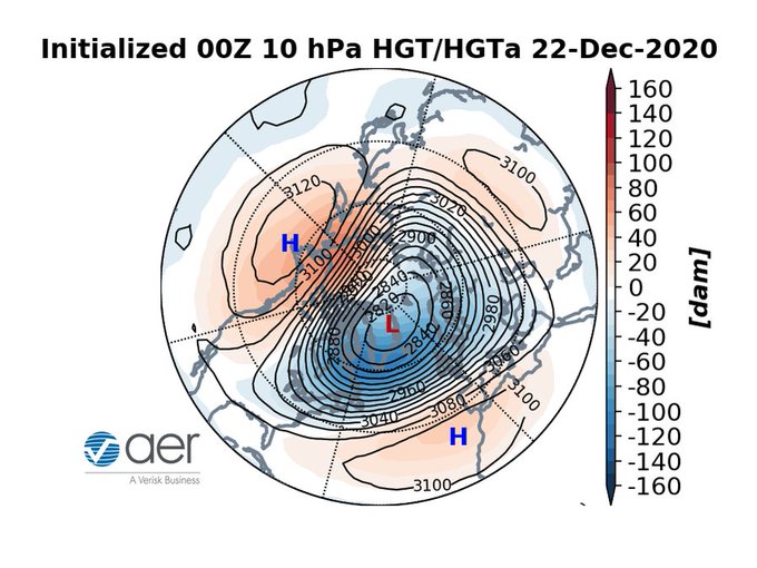
1/Often with #polarvortex (PV) disruptions the stratosphere leads the troposphere. Currently the PV is split into two vortices separated by high pressure. In a week's time textbook Rex (high over low pressure-60W) & omega (Greek letter-60N) blocks are predicted in the troposphere
If you're looking forward to spring weather in the Eastern US, next weekend is going to hurt, looks #cold possibly even record cold. I'm advocating December be replaced by March in the winter month club. Though not sure "I am dreaming of a white St Patty's Day" has the same ring.
Mid-tropospheric ridges along and off shore of the US and Europe will contribute to a more amplified trough to the East bringing the first credible threat of widespread #snowfall to the Eastern US and Central & Eastern Europe next week.
GFS predicting that a heat dome will form over Northern Siberia next week bringing with it well above normal temperatures. Some of very warm weather could spread fro Siberia into the Central Arctic.
The December 28 2020 blog accurately predicted the upcoming weather across Europe based on the #PolarVortex disruption. But now my thinking for North America is at odds with the weather models-so I pulled out my winter bingo card, what space did I land on? https://t.co/DHrQlUsLWp
GFS still predicting a #polarvortex (PV) split with this morning's run. Of course still an open question if we get a PV split but also does the N America daughter vortex end up in eastern N America? Could it allow a return of wintry weather to Eastern US sooner rather than later?
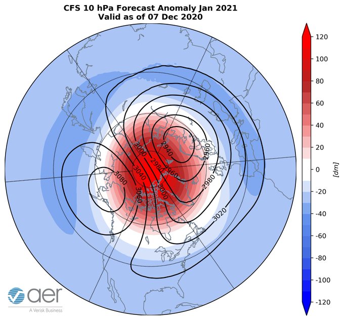
This week's blog is all #PolarVortex (PV) all the time. Latest CFS predicts classic PV disruption for January. i give my thoughts for different scenarios and the implications for #winter weather for the US, Europe, East Asia from weeks to months: https://t.co/NBg26lakvl
Looks like the next two weeks will live up to the moniker "dog days of summer." Ridging centered over the Central and Eastern US will bring persistent #heat to much of the country.


