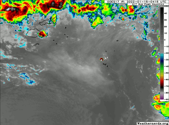
You can actually start to see the westward propagation due to stratospheric easterlies on one side of the plume where the BTs are warmest (-30 to -50C).
Note colder east side though & this plume portion appears stationary or expanding west, possibly w/ flow below the tropopause.
Watching how the latest MJO event has come into focus in Hovmöller diagrams the last 10 days has been illuminating.
This Mid-Aug MJO event could be the most substantial of the TC season so far. We mostly had smaller/faster Convectively Coupled Kelvin Waves in June-July. https://t.co/yGPyz0PjN8
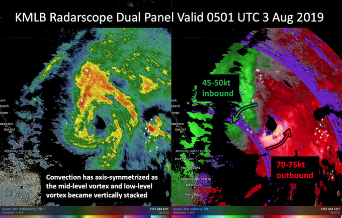
Concerning trends with #Isaias tonight.
The earlier radar hole now appears to becoming a bonafide eyewall with significant inbound & outbound velocities on KMLB radar. The low & mid-level center now appear aligned as convection axis-symmeterizes.


