
Alasdair Raeさんのイラストまとめ
@undertheraedarFollow @undertheraedarさんをフォローする
Maps, stats, data, cities, density, elections, gifs, geo + QGIS training with Map Academy - founder of Automatic Knowledge
automaticknowledge.co.ukフォロー数:3970 フォロワー数:43740
3 件中 1〜3件を表示


Me exploiting today's 'half the UK population' discourse
(I calculate that 33.6 million people live in the red areas)
9
44


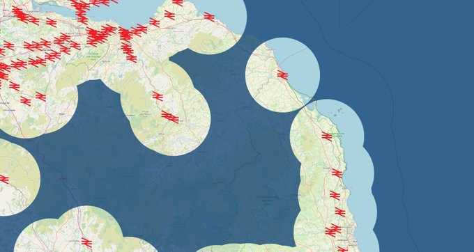
Map of the day today is all areas of Great Britain within / not within 10 miles of a railway station, and is Berwick the only lonely circle?
173
833

A little bit of map fun today with elevation data - a kind of topographic map, with lower elevations filling up first - spot the Danube, the Alps and all sorts of other things (elevation data from @CopernicusEU)
53
276