//=time() ?>
Map shows rail journey times in the Austro-Hungarian Empire. The cities bubbles do correlate with the 1910 population census.
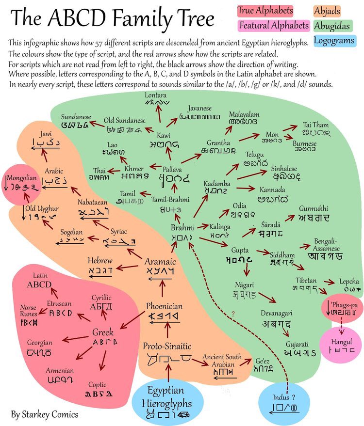
These 57 different scripts have ultimately evolved from the hieroglyphs the Egyptians used over 5000 years ago.
Wonderful map shows time spent under Roman rule.
Rivers of South America, coloured according to the major hydrological basins they are part of.
The Leo Belgicus (1586). Map of the former Low Countries (current day Netherlands, Luxembourg and Belgium) with the shape of a lion.
As Gorbachev bows out, a new iron curtian is descending.
🇷🇺 Russia if its federal subjects were proportional to their population.
Cute map shows Astérix and Obélix's travels.
Greek-speaking areas during the Hellenistic period. During antiquity, Greek was by far the most widely spoken lingua franca in the Mediterranean world.
Rivers of South America, coloured according to the major hydrological basins they are part of. By @PythonMaps