
Python Mapsさんのイラストまとめ
@PythonMapsFollow @PythonMapsさんをフォローする
フォロー数:510 フォロワー数:78019


Contour line map of Germany. I used 50m contours and created the dataset with GDAL.
Comment and let me know which country I should make next! #DataScience #Datavisualization #Geography #Germany #Topography #ContourMap #Python

Bit of Saturday night fun. Here is a contour map showing topography of Northern Europe during the last ice age when sea levels were 122m lower. What would the world be like if Doggerland still existed? #Data #DataScience #Datavisualization #DataScientist #Geography #Europe

Contour line map showing the topography of Nicaragua.
This map was made with #Python. Comment and let me know which country I should make next! #Data #DataScience #Datavisualization #DataScientist #Geography #Nicaragua

Contour line map showing the scale of South America. I used 50m contours and created the dataset with GDAL.
Comment and let me know which country I should make next! #DataScience #Datavisualization #Geography #Brazil #India #Colombia

Discover Romania's topography in a new light with this Python-made contour map. From rolling hills to dense forests, it showcases the country's diverse landscapes. #Romania #Topography #ContourMap #Python


Contour line map showing the scale of the Himalayas. I used 50m contours and created the dataset with GDAL.
Comment and let me know which country I should make next! #DataScience #Datavisualization #Geography #India #China #Bangladesh #Himalayas

Discover Costa Rica's topography in a new light with this Python-made contour map. From lush rainforests to rugged coastlines, it showcases the country's diverse landscapes. #CostaRica #Topography #ContourMap #Python

Where are the world's shipping lanes! This really highlights maritime trade routes.
#Python #MaritimeMap #ShippingLanes #GlobalTrade #OceanTransportation #FreightFlow #CommercialShipping #TransportationGeography #MaritimeIndustry #TradeRoutes #LogisticsMap
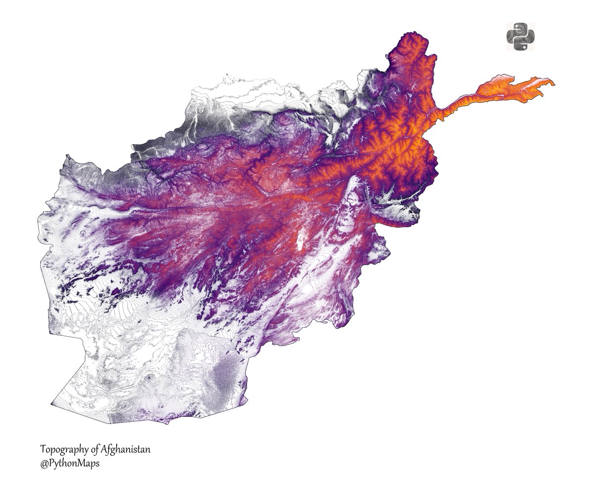
Explore Afghanistan topography like never before with this Python-made contour map. From mountains to deserts, it showcases the country's diverse landscapes. #Afghanistan #Topography #ContourMap #Python