USGSのTwitterイラスト検索結果。 2ページ目


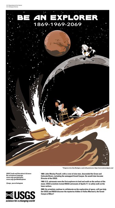
100 years after John Wesley Powell's first expedition to explore the Green & Colorado rivers, the Apollo 11 mission explored the moon. USGS scientists made the first lunar maps and trained moon-walking astronauts. Next up… Mars? Artwork by @NightSkyPark #USGS_Astrogeology #NASA


☞「最大震度レベルⅥ」の地震、被害レベル大>日本も要警戒!
<世界の地震活動>USGS
地震規模 M 5.6
震源地 フィリピン、ドーロのWSW2km
時間 2019-07-09 21:37:01(JST)
ロケーション 6.802°N 125.169°E
深さ 24.0 km
津波 脅威情報なし
ShakeMap ⇩


Volcanophiles, an #IAVCEI group are developing community-wide considerations for responsible communication of volcanic hazards on social media, and need your perspective. Please fill out the survey linked below by April 12, 2019 to contribute https://t.co/1a1yW1sayJ (pic:USGS)

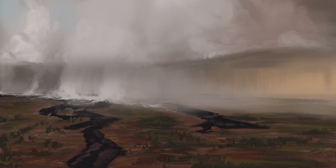
Here is a volcano study from thursday. Its based on a USGS photo from the recent eruption in Hawaii.


#HVO/#USGS Volcanic Activity Notice
for #Kilauea: Steady lowering of lava lake at summit of #KilaueaVolcano has raised potential for explosive eruptions in coming weeks. https://t.co/7sDZqcOJ5s @CivilDefenseHI will issue alerts if needed: https://t.co/uYm7YGqOmq #KilaueaErupts


Rebuilds for Print - USGS TOPO Maps of the Republic of Palau: https://t.co/jTk02n9Wjt
I do so love island maps.


interesting infographic from the USGS showing the history of planet earth. http://t.co/Gh49p6g5P8

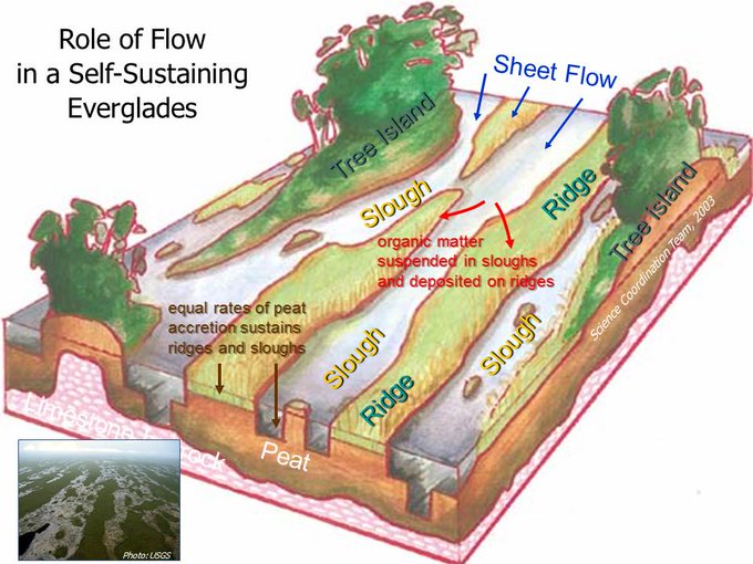
how much flow is needed to revive habitat for #Everglades aquatic life poses USGS research http://t.co/lOlyex7U4b


Digital composite sketch trying to bring things to life a bit before projection and transfer. #USGS #earthscienceartsc