USGSのTwitterイラスト検索結果。 29 件
🗺️A Map Showing Terrain Model of Mt.Rainier 🏔️( Pierce County, Washington, U.S🇺🇸) Data source from @OpenTopography (USGS10m) #MtRainier #gischat #cartography #dataviz #QGIS #Blender3d #DataVisualization #Geospatial
Magnitud y profundidad reportadas por diversas agencias sismológicas:
Mw7.74🇫🇷39 km (IPGP)
M7.7🇰🇷 (KMA)
M7.6🇩🇪10 km (GFZ) [Preliminar]
Mw7.6🇺🇸61 km (USGS)
M7.6🇨🇳70 km (CENC)
Mww7.6🇦🇺83 km (GA)
M7.5🇮🇳101 km (NCS)
Mwpd7.4🇮🇹91 km (INGV)
M7.3🇲🇾113 km (MET)
Mwp7.2🇪🇸106 km (IGN)
Data viz practice: shrinking glaciers, Glacier NP Montana (1966 - 2015).
Data: Fagre et al 2017. Glacier margin time series (1966, 1998, 2005, 2015) of the named glaciers of Glacier National Park, MT, USA, USGS data release https://t.co/BVSeKkI7dU
Repo: https://t.co/2JotWJLeo1
<世界の地震活動>USGS|M5.0以上
地震規模 M6.0
震源地 プリンスエドワード諸島地域
時間 2021-12-19 05:05 JST
位置 47.10S33.45E
深さ 10.0 km
津波 脅威情報なし
☟アンドリューバイン破砕帯付近の中規模地震>今後も警戒必要
<世界の地震活動>USGS|M5.0以上
地震規模 M 5.5
震源地 ニュージーランド、ブラフSW298 km
時間 2021-11-05 01:36 JST
位置 48.261S165.216E
深さ 10.0 km
津波 脅威情報なし
☟マッコーリー海溝北東部付近「推定最大震度Lv.Ⅲ」の中規模地震>今後も同規模地震に警戒必要
9月22日朝に浮かんだ文字
『M6』…9月22日18時57分
中米ニカラグア M6.5(USGS)
『M6』…9月24日20時52分
アリューシャン列島 M6.1(USGS)
『M7』
『M7』
『M8』
『5十』
『6-』
『6十』
9月23日夜に浮かんだ文字
『M6』…9月27日15時17分
地中海クレタ島 M6.0(USGS)
『M6』
『M6』
『M7』
【9月22日06時ころに
浮かんできた文字】
『M6』…22日18時57分
中米ニカラグア地震
M6.5 (USGS)
『M6』…24日20時52分
アリューシャン列島地震
M6.3(USGS)
『M7』
『M7』
『M8』
『5十』
『6-』
『6十』
【9月23日18時ころに
浮かんできた文字】
『M6』
『M6』
『M6』
『M7』
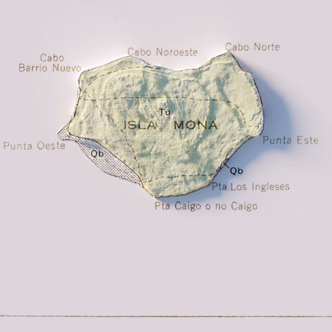
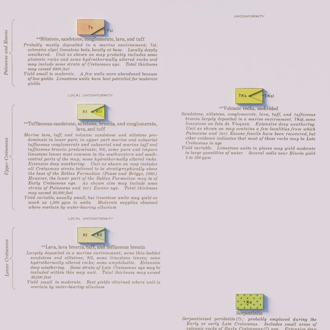
Hydrogeologic Map of Puerto Rico and Adjacent Islands - USGS - 1965
#arcgispro #b3d #PuertoRico #geology #geography #GIS #dataviz #cartography
Topographic map of Venus
NASA / JPL / USGS / Russian Academy of Sciences / Arecibo Observatory / P. G. Ford / G. H. Pettengill / D. B. Campbell / Donald P. Mitchell / @DanielMachacek_
Full size at: https://t.co/GpazchBZ6j
I roped in 16 bumblebees this past hitch! Not too bad for my first hitch as a field technician for the USGS!
Do they make bumblebee belt buckles I wonder?
#Ecology #USGS #fieldwork
【M7.2】 2021年3月20日18時09分 宮城県沖 D60km 最大震度5強
https://t.co/ZAkXaBpk9T
https://t.co/6XezVLNFAY
【M7.0】 #USGS 速報値の【M7.2】から下方修正
https://t.co/eKZYq3bqf6
These USGS maps of Pennsylvania are gorgeous—I love the river meander breaking out beyond the western margin of the first map.
Did you know … that during the 1999 Whitemud Road Landslide in Edmonton, bank material at the top dropped 18 m towards the river destroying 7 homes that had great views of the valley. Most of the displacement occurred in one day. Thx to the USGS. https://t.co/dVixcuievE @yeg
アラスカ州で大きな地震。USGSによるとメカニズムは逆断層で、深さ28キロ。規模が大きいので現地では津波のおそれもあります。周辺での地震の分布(1900~2016)を見ると、マグニチュード8クラスが発生している場所だということがわかる。日本でも「潮位の変化」に注意が必要です。 #地震
さきほど日本時間15時12分頃のアラスカの地震M7.8(USGS)、太平洋プレートの沈み込む方向に圧力軸を持つ逆断層型。プレート境界型でしょうか。1964年のM9.2の震源域からは西に離れた、1938年M8.3のあたりでしょうか。USGS
◆四国はるか沖M6
昨日7/17 05:03発生
四国はるか沖M6/D555km
(USGSではM5/D550km
フィリピン海P-太平洋P
境界超深発地震
その約20分後に茨城沖
5:22-M3.9/D8km
5:26-M4.3/D62km
これは明らかに誘発地震
何れも震度0なので気象庁
の発表は無いがM5~6規模
を発表しないのは防災上も
好ましくないと思う


