ElevationのTwitterイラスト検索結果。 393 件中 14ページ目
~ "unconcealed elevation"
~ "memory of the past"
~ "Beyond his eyes"
~ "distance away from"
#sk_8
This is one of my favorite maps, and I love the elevation changes. Who/what do you think might live on this isolated island?
The Island Plateau battle map:
https://t.co/dEwEBWQeTl
#dnd #dnd5e #ttrpg #dungeonsanddragons #maps
Elevation absinth bottle illustration by Natalie Shau, via Behance
#FabFantasy
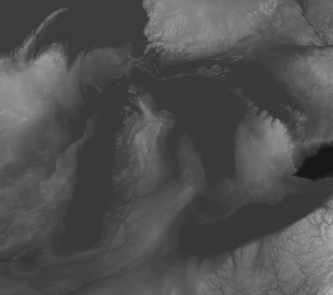
Once I had a good correspondence between new and old, I reversed the transformation, taking a modern elevation dataset and warping it into the space of the old map.
Pretty sure the perspective is messed up on this one lol. I tried to draw an environment with uneven elevation with houses maybe slanted though tbh I'm not sure how it properly affects it. Maybe I should get into 3D modelling lol
#digitalart #art #under1kgang
💎 Elevation Waves 💎
✨ Artwork by @silviovieiraart
💰 Sold to poolisa01 for 1.3 ETH ($1,577.81)
https://t.co/vDmaFKaqZ7
#cryptoart #NFT
Elevation of a Candelabra, 1810–1830 https://t.co/3Ug5agcPdU #smithsonian #cooperhewittdesignmuseum
"Elevation Waves"
1/1 @SuperRare
https://t.co/xd3UkTKl2f
#NFTs
#cryptoart
#silviovieiraart
#visionaryart
#visionarycryptoart
The person worked with him on Kirby 64 and is still with Nintendo.
I asked if he liked him. Paraphrase: "I didn't KNOW him, but he was nice to everyone."
Something occurred to me
What else happened in 2002? Iwata's elevation. Maybe instead of passing away, he was PASSED OVER..
Statric > Columber
Flying/Electric
Based on a storm cloud, lighting sprites and jellyfish.
They live in the outer edges of the atmosphere and come down to lower elevations to feed on the electrical build up in clouds.
#fakemon #Pokemon #DigitalArt
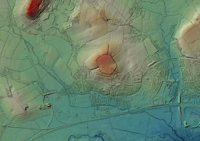
A quick visit yesterday (past) Norton Camp Hillfort, Norton Fitzwarren, Somerset. Low elevation site, on the end of a low rise of land. #Neolithic'ish to R/British occupation enclosure w/well described #holloways to the site (no time for exploration tho' ☹️). #HillfortsWednesday
Worley field contours by JunkBOt
Another drawing in a series of faux contour #maps
Instead of elevation based contour lines these are the color gradients of the contoured Worley Fields.
Source made with #RStats
#plottertwitter #art #drawings of #generativeart #Map
Contemporary #Elevation #Data and #Historical #Maps Merge in #ScottReinhard’s Digital Works https://t.co/Mg8NFqhp7G
🔥This week's Artist Highlight on @SpacedPainter's NFT Collection is @silviovieiraart Silvio has a unique style you can immediately recognize when you see his beautiful NFTs😍
🔥1/1 "Cycles Of Elevation" for sale:
👉https://t.co/5q7voOmWY5
#dontsleep #cryptoart #raredigitalart
Cartographer and ortho-imaging specialist Sean Conway takes flat vintage maps and turns them Into 3D relief maps showing highly detailed elevation profiles https://t.co/Edxu7Be9Fk
Another batch of @USGSTNM 3D Elevation Program (#3DEP) #lidar pt cloud data accessible via OpenTopography. 175 datasets, 4.4 trillion pts, ~800k sq km (red in map below): https://t.co/Btpeug1PQF 📷 1) Ivanpah Solar Station, CA; 2) Shiprock, NM; 3) braided streams Deadhorse, AK
Birch on the other hand was kind of a nightmare, mostly on account of terrain elevation and that the trees covered up a LOT of the background, it took a lot of thight squeezes with the Smash camera to get the shots needed for this one.
i tried making higher elevations lighter but it didnt look as good 😅
Good (or at least, interesting) news! A new record for highest-dwelling mammal has been set. In February, a yellow-rumped leaf-eared mouse was caught by scientists at the summit of Llullaillaco. That's an elevation of 22,110 feet!


