IsaiasのTwitterイラスト検索結果。 68 件中 3ページ目
Early stream tonight due to Isaias saying hello to me tonight! Working on Chibi Kiryu from #Yakuza! Come and join the fun!!
https://t.co/g1KQZUgKke
#yakuza0 #yakuzakiryu #yakuzagame
Its a Monday, a Monday that requires us to batten down the hatches, bring in the deck furniture to the porch, secure the pool floats, move my pots of herbs and cover the grill, but its #MajesticMonday too, so there's that ! #Thorin #HurricaneIsaias. #Hugs
Concerning trends with #Isaias tonight.
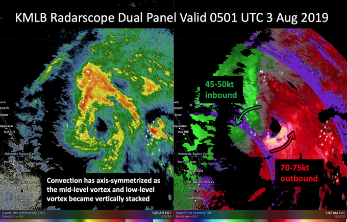
The earlier radar hole now appears to becoming a bonafide eyewall with significant inbound & outbound velocities on KMLB radar. The low & mid-level center now appear aligned as convection axis-symmeterizes.
Been so busy at work last 8 hrs I haven't been able to check on #hurricaneIsaias .
That is looking pretty damn organized again and that eye is apparently a pin point eye. Very small. Still more Northeast dominate but back up to 80mph. :O
Hurricane Isaisas (ees-ah-EE-ahs), uncertainty, could possibly hit East inland Florida, yet predicting pushing West slightly in Ocean.
Reside on E. Coast, will be impacted somehow. Prepared. Will keep all posted.
#hurricaneIsaias
Will take a bit tonight for #Isaias to get going again fully but the structure is clearly there for it to go. It's trying to get that classic comma shape to full wrap up but just as a little bit of dry air it's fighting right now on the West side. The core is very much alive.
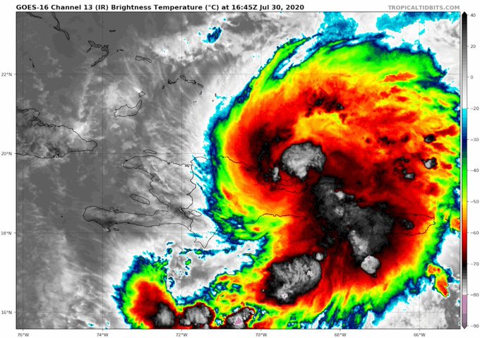
Very interesting look at #Isaias . It's trying to comma up slightly right now but it's fully back over water and look at the huge explosion of storms off the East of the center. Just a matter of when that curls around now and the storm can go. 100% will be a hurricane.
A GMI overpass from a couple of hours ago showed a healthy convective banding pattern in Tropical Storm #Isaias. There are hints of an inner-core forming, which could result in Isaias becoming slightly more resilient to vertical wind shear in its path.
Gonna be interesting now that Tropical storm #Isaias is finally now formed. If that can survive Hispaniola there is a chance if this can fight off the shear in the Bahamas this could be a significant hurricane. Models been trending to more of a stronger solution and storm Sat.
A look at the atmospheric moisture feeding into #PTCNine fueling heavy rains and possible flash floods & mudslides for #PuertoRico and #Hispañola. This system is likely to be named #Isaias and impact #Florida this weekend. https://t.co/NU4Ndyle22


