TopographyのTwitterイラスト検索結果。 27ページ目


Today's recommendation is MS 700, from our Board member @conor_kostick. It's over 800 years old, and contains The Topography of Ireland and The Conquest of Ireland. These Latin texts by Gerald of Wales describe his view of Ireland and the Irish after the Norman conquest.


Spec updates
Topography, updated grassland size chart and waterway size charts. Still plenty to do.


Two new @LINZLDS #lidar datasets now avail from OpenTopography: Palmerston North, Manawatu-Whanganui, NZ 2018; Christchurch & Ashley River, Canterbury, NZ 2018 - 1100 sq km of data: https://t.co/Gjfy0DIZiT 📷 1: wind turbines in motion; 📷 2: lidar intensity, Waimakariri River


My dumb butt thought "Free Day" prompt meant free day in the week like in the game. Here's Cyril learning stuffs from a book on maps and topography. Lysithea is teaching him words he doesn't know.
#CysitheaWeek2020


Joan Wyatt's A Middle-earth Album (1979) offers up another of its strangely compelling images tonight - The Forbidden Pool. The topography of the landscape is odd here, but I still love the tiny hunched shape of Gollum perched on his rock.
Jackson's Faramir anybody? #Tolkien


Professor Lam Siu-por 林兆波教授,Geometric progression in Algebraic Topography. ( Real formula 大數據分析真實公式 )
Algebraic topology is a branch of mathematics that uses tools from abstract algebra to study topological spaces.


the armature + rig are -basically- done
aside from a few weight painting issues and some topography/shape key nonsense this is turning out to be really, really good for my second highpoly, from-scratch model


@BouchDaBat thanks! imo it doesn't lend itself to the topography very well though since there's still a lot of distortion in the lower backside of the torso and on other, smaller parts of the model, but beyond that i'm actually super proud of how these turned out!


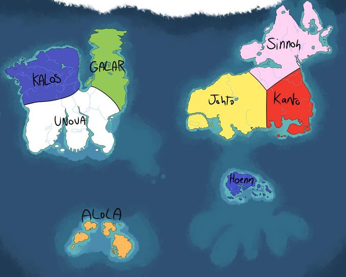
before i sleep heres the updated pokeau map ! ft topography kinda this time.
its. 13mb. 5000x4000px. help


Six new @NCALM_UH #lidar datasets now available from OpenTopography. CA sites: Sacramento–San Joaquin River Delta; Horseshoe Lake & Hilton Crk Fault near Mammoth Lakes; Antelope Valley Ranch. Idaho Batholith. Goat Rock Volcano, WA. Campeche, Mexico. https://t.co/zX5InOcfY8


Finalizing my plots of paleo-topography, this one at the LGM (20000 years before present). Very soon, I hope that my paleo-topography datasets will be available for everyone!

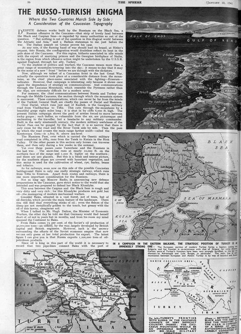
“The Russo-Turkish Enigma - Where the Two Countries March Side by Side: A Consideration of the Caucasian Topography” | The Sphere - January 18, 1941 #caucasus


Day 25 #31DaysofYAM close up/zoomed in/cropped: ink wash skull by Sara, charcoal shell by Ellie, charcoal glass “fish in a bag” by Ryan, pastel topography map by Liam #hvartsed


fleshing out my map more! working on topography and the region markers


Cow do you do?
(Okay, I'll get my coat)
The cow-stag of Chester, in The Topography of Ireland by Gerald of Wales
Royal MS 13 B VIII, f. 19v
https://t.co/KLo0DWgEjv


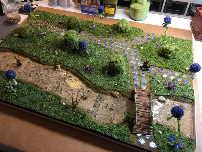

In Amynrath, my homebrew world, the Feywild topography is named for people and places in Tal'Dorei. The Artagan Bridge allows adventurers to cross the mystical waters of the Garmelie River and continue to the mysterious fungi village of Shademurk! Thank you, @matthewmercer! #DnD


Earth topography in the color of Mister Rogers's sweaters. Because I can.


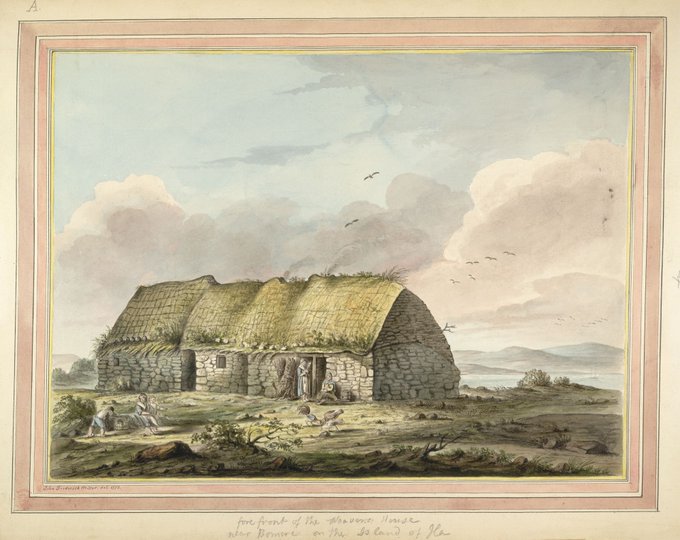
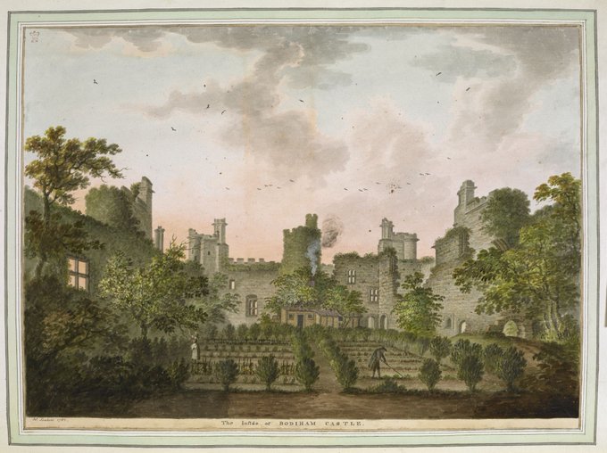
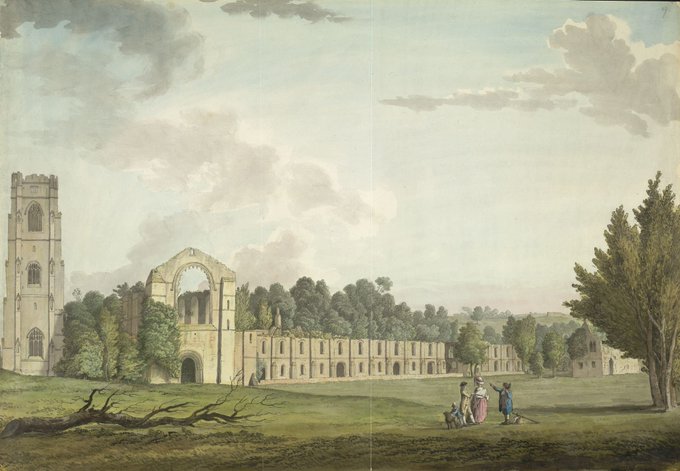

Are @britishlibrary topographical drawings concerned with ‘topographical research, and very little or not at all with Art'? Putting topography in its place: https://t.co/xlds2ALXSB