ALwxのTwitterイラスト検索結果。 9 件


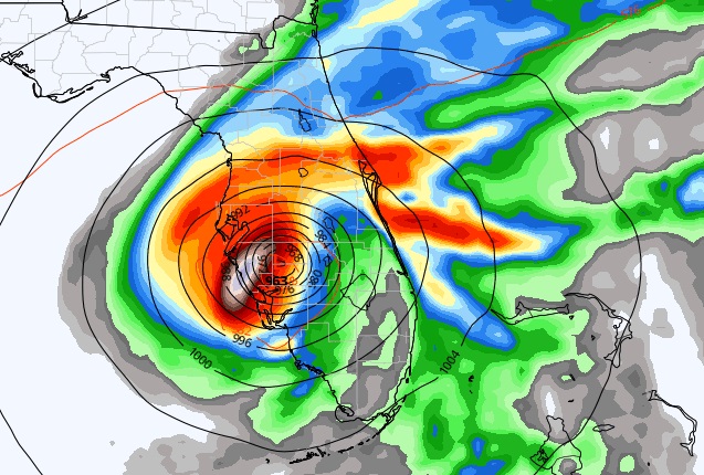

Right now Invest 98L is just a trop. wave. Global models strongly suggest this could become a hurricane in the Gulf next week. For who? EURO still likes the Fl. Peninsula. The GFS still favors the Panhandle. Way to early to know. AF RECON will investigate 98-L this evening #alwx


System is taking shape over Arkansas and will be moving in overnight and into the AM. Snow could start falling as early as 8 AM for our area and travel will become very hazardous as the snow will "flash freeze" on roadways and exposed surfaces #alwx


New zoom for the GFS, NAM, RGEM, 4km NAM and HRRR added today. #VORTEXSE #WxChallenge #ALwx https://t.co/xjMC8EicfO


Dual-pol hail signature S of Henagar in Dekalb Co - 4:15pm: Reflectivity > 50dbZ & low differential reflectivity. #alwx

#27Apr2011 4:25pm UAH students in the mesonet vehicle (M3V) sample the inflow layer of the Tanner EF-4. #alwx