NSStormのTwitterイラスト検索結果。 5 件


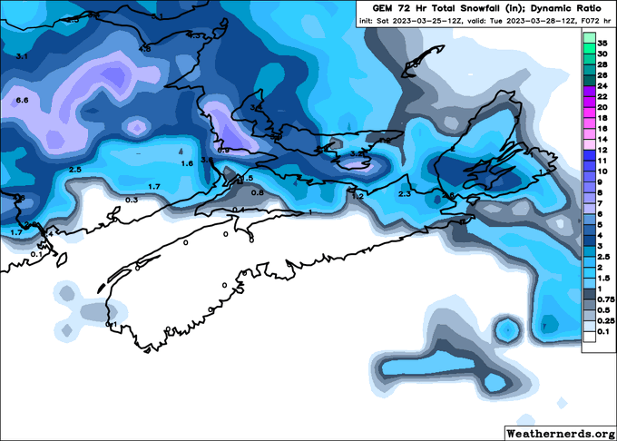
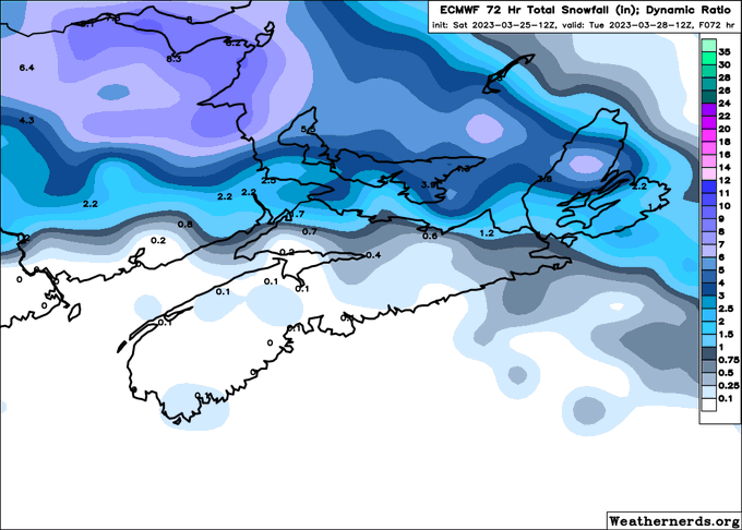
Looks like the evening models aren't too excited about the #snow potential in #NovaScotia. Most of them show only 2-5 cm for much of NS, except along the Northumberland shore.
Caveat: I don't know if these "snowfall" amounts include ice pellets or not.
#NSStorm


Trained behavior divined a pretty miraculous analogy [tip: save as mobile wallpaper] #ml #Fiona #debatdeschefs #MahsaAmini #BiVisibilityDay #NSStorm


The latest (12Z) HWRF and HMON runs show an absolutely RIDICULOUSLY intense post-tropical hurricane #FIONA hitting #NovaScotia on Saturday at 6 AM.
914 mbar? That would be the strongest landfalling extratropical storm anywhere in the WORLD. #NSStorm #PEStorm #NLwx


Those thunderstorms just west of #NovaScotia 2.5 hours ago are on their move east-northeastwards.
They will be near #Halifax in about an hour or so.
Another set of t-storms just started firing up in the Annapolis Valley.
Expect heavy downpours in t-storms.
#NSStorm


Cartoon for @chronicleherald Keep in mind I drew this Friday. It would have been a more fresher joke on Friday than today. #shapiegate #Trump #nspower #NSStorms #nspoli