mapotdのTwitterイラスト検索結果。 2 件

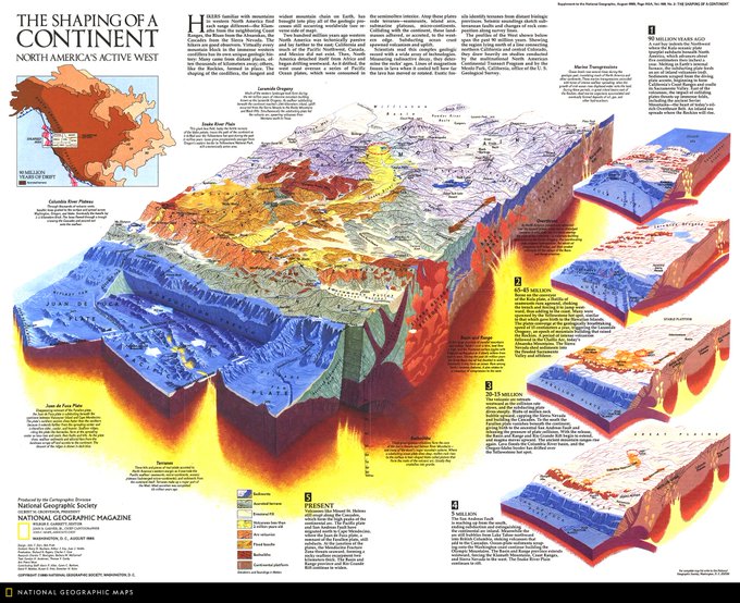
Map of the Day: This graphic depicts the shaping of the North American continent. Published in August 1985, the geologic profiles of the west span the past 90 million years, showing the region north of a line connecting northern California and central Colorado. #MapOTD
29
69


Venetians are used to getting their feet wet; efforts to alleviate the long-term effects of water are part of daily life in the city. This August 2009 map shows how during the acqua alta, unusually high tides cause floods. The lowest lying areas are most often inundated. #MapOTD
23
61
もし、気にっていただけましたらTwitterやブログで宣伝していただけると管理人が喜びます。
ツイートする