
Cartographers' Guildさんのイラストまとめ
@CartoGuildFollow @CartoGuildさんをフォローする
フォロー数:4972 フォロワー数:9559


From the archives...
Map of the South Wilds, by @Akae06
"Another map for the tabletop RPG RuneQuest
Hand made : ink on paper and text and color on photoshop"
https://t.co/4v9a8JZZlr

Lounaka Village, by @Lerb_Ash
"This one started as a mapvember prompt I decided to actually finish properly. It was fun."
https://t.co/Tqg9pXSDyt


Twin Skull Den, by @N_Horizons_maps
Maps made for Patreon...
1. darker map with a green bright river, possible acidic
2. a snowy version
3. again in a darker tone, but this time with a tasty fungi casting dim light all around
https://t.co/HD1FJ1RfpC

Village Map - Iso (bird's eye), by Randy M
"An isometric style map of a little village tucked away in a gully. Plenty of nooks and crannies for folks to poke around in."
https://t.co/E0McUX3FPf


Illustrated Map - Iso (Lair of the Fen Drake), by Randy M
"An illustrated map depicting the innards of a hill. Done using Procreate and finished in ID (text layer). I've also attached the ink base."
https://t.co/yjohsaI7Wy

Hamlet of Magefork, by Sithra
"I did this map as a low level quest hub for a table top RPG. The hamlet started as just a mage tower, but soon had small folk settling in the area."
Made in Inkarnate
https://t.co/Z4ncpjG0T7

Untitled map, by Angus950
Made in Inkarnate
https://t.co/TAK4PGOiHB
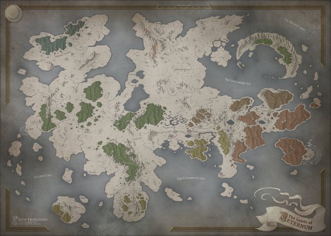


Aeternum, by @N_Horizons_maps
Privately comissioned map
https://t.co/CmbUOdEF8V

Late medieval Louka Monastery, by @MyRustyGun
"it shows the Monastery of Louka, located near Znojmo in Czech Republic, by the late 15th century. The reconstruction is based on depictions from the 16th and 17th century."
https://t.co/8C646uKgW5

From the archives...
Village of Formene, by @jstevensonart
Part of the larger Greyvast setting (more info at the link below)
https://t.co/5yOFKUs30m