
LOCMapsさんのイラストまとめ
@LOCMapsFollow @LOCMapsさんをフォローする
フォロー数:86 フォロワー数:33735


These beautiful Japanese maps depict locations in Buddhist cosmology and geography: the mythological world, the philosophical world, the real world, and India, where Buddhism originated.
Explore the maps here: https://t.co/az1tOkR7vX

Looking for some magnificent maps? Check out our new blog about maps posted on the Library's website from the World Digital Library project! There are some pretty fantastic maps available including this "Man of Commerce" map!
Read all about it here: https://t.co/IjtDpRqJa2

Have a look at this fascinating world map from 1944. The map was produced from a photograph of a transparent globe which enables one to observe the spatial relationship of the continents.
Check it out: https://t.co/8ZJCbRIIxT


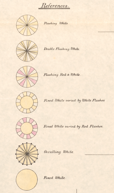
This fascinating 1894 map denotes the signal patterns of lighthouses along the coast of China!
See the full map here: https://t.co/S9p69Rw8l8


In the 17th century, Athanasius Kircher thought volcanic activity and the movements of tides could be explained by the subterranean world. He created these maps to illustrate his center of the earth theories!
Read more about it in our new blog post here: https://t.co/05OUxKSiNo

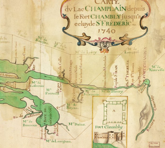

This 1740 map of Lake Champlain jumps off the page with vivid color!
Take a closer look here:https://t.co/fjKKNLZDca


This colorful 1892 map shows population density across the United States and includes the nation's geographic center of population from 1790 to 1890!
Take a closer look here: https://t.co/elltqhBvb2

This striking 1929 map, full of vivid colors and textural details, depicts #LosAngeles as it was in 1871!
Take a closer look here: https://t.co/wb5N6HH2oi
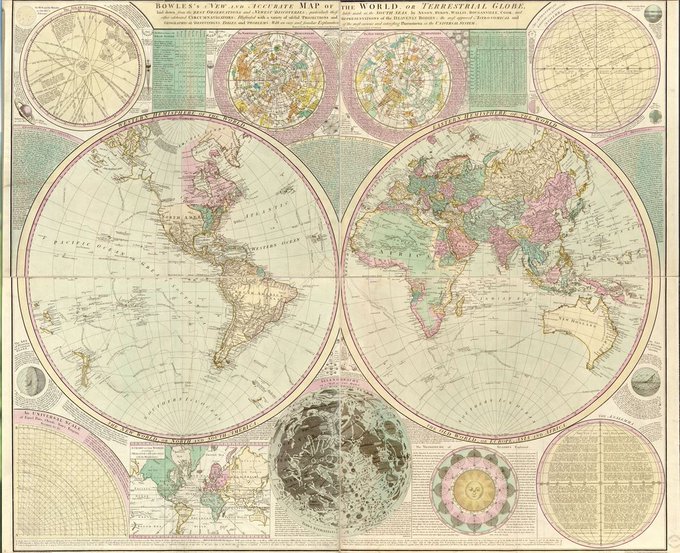
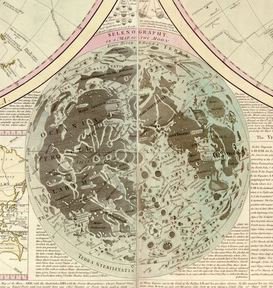
Check out this 1780 map which is not just of our globe but also includes a map of the moon's surface as well as other planets along with fascinating other details!
See the full map here: https://t.co/goIn0Q3occ


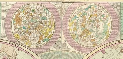
This fascinating 1799 world map is ringed with diagrams defining geographic features and astronomical phenomena!
Take a closer look here: https://t.co/mjALpcChjp