
LOCMapsさんのイラストまとめ
@LOCMapsFollow @LOCMapsさんをフォローする
フォロー数:86 フォロワー数:33735

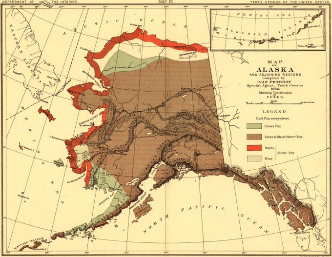
This map shows the distributions of #foxes across #Alaska in 1882!
Take a closer look here: https://t.co/R97oijvy5e

This map charts the path of the April 25th, 1846 #SolarEclipse, which was visible across most of the contiguous United States!
See the full map here: https://t.co/kWHKITaNOU

Check out this map of San Francisco from 1908!
It shows rebuilding efforts after the infamous April 18, 1906 earthquake and resulting fires.
https://t.co/4n3cTmPB3i
#history #primarysources #SanFrancisco #California

This beautiful panoramic map shows the Panama Canal, as proposed by the French in 1881!
Nearly 1000 ships traveled the 48 miles (77 km) long canal during 1914, its first year in operation!
You can download a high-res version here: https://t.co/yOkO6PrbLU