
NOAA Satellitesさんのイラストまとめ
@NOAASatellitesFollow @NOAASatellitesさんをフォローする
フォロー数:648 フォロワー数:1455669


Since #EarthDay is next week, we wanted to share this very special painting for #FullDiskFriday.
Commissioned in 1954 by Dr. Harry Wexler, a meteorologist with the U.S. Weather Bureau, it imagined what a satellite might "see” from orbit—before the first one was ever launched.

On Sept. 14, 2020, the #GOESEast satellite zoomed in on Hurricanes #Sally, near the Gulf Coast, and #Paulette, over the Atlantic. We can also see a blanket of hazy gray smoke from western #wildfires drifting over most of the country.
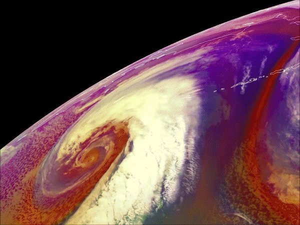
#GOESWest watched over the Aleutian Islands as a hurricane-force low moved into the area on Feb. 24, 2019. More imagery: https://t.co/Wtd6iB1hXw
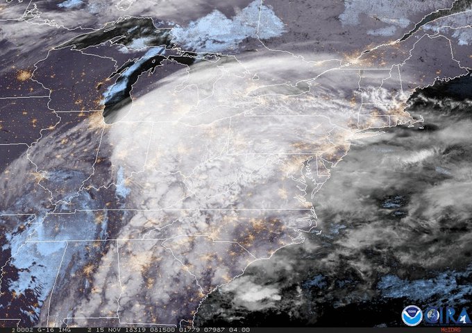
Who else is super pumped for this #snowday? #GOESEast captured this view of the winter storm that's bringing snow, sleet and ice to parts of the East Coast. More imagery: https://t.co/NhKMBeSoww

Now in #NOAAView, you can export data like this weekly Sea Surface Temp to #GoogleEarth. http://t.co/EEPKB7lLe5

Satellite measurements help determine Tropical Cyclone Heat Potential. July 7-13 data imagery. http://t.co/KHtNCjKrmf