
Dr. Levi Cowanさんのイラストまとめ
@TropicalTidbitsFollow @TropicalTidbitsさんをフォローする
Follow for expert, factual, no-hype hurricane analysis
フォロー数:1170 フォロワー数:115421


Meanwhile in the Bay of Bengal, the developing tropical cyclone there appears stronger today than most model guidance predicted this early. Several days before landfall yet, but this storm is guaranteed to bring dangerous impacts to SE Asia and/or India next week.
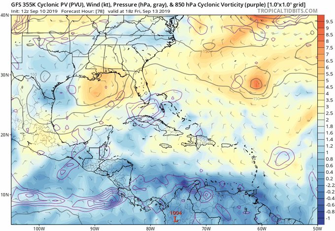
[#NerdTweet] With this gulf disturbance, if sfc low rotates to NE side of the upper low, shear decreases, and erosion of the +PV anomaly via diabatic heating would allow favorable interaction.
If SW flow is maintained over the disturbance, though, development chances much lower.

Model trends today are for #Dorian to get closer to Jacksonville, FL & Savannah, GA than previously forecast.
While still expected to be offshore, the storm core is now rather large, and risk of storm surge, rain flooding, and damaging winds is growing. Don't sleep on this one.


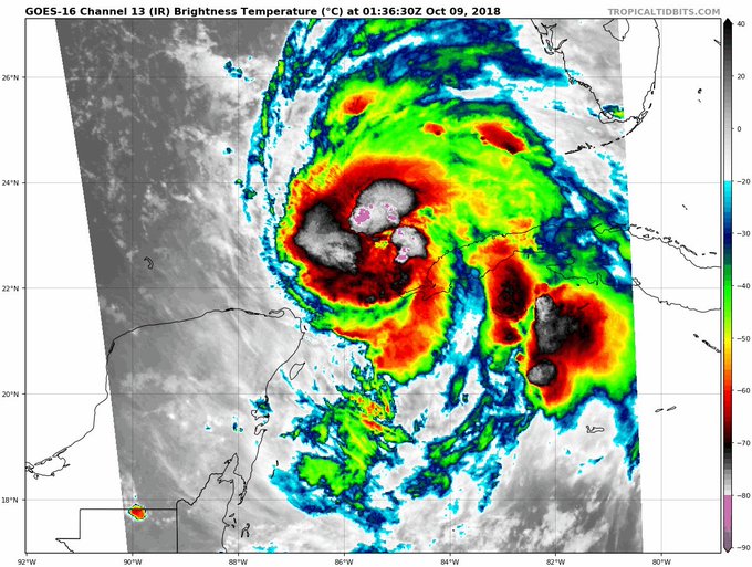
#Michael continuing to construct an inner core tonight, a continued sign of a maturing hurricane. So far there are no indications that Michael won't become very strong, as forecast


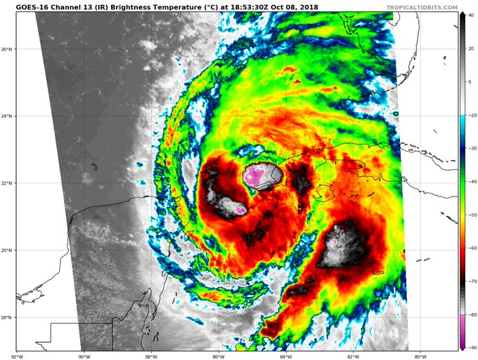
#Michael has become a hurricane.
Expected to strengthen into a major hurricane (max winds around 120 mph) before landfall in Florida Panhandle on Wednesday.
Life-threatening storm surge, wind, and inland flooding expected.
Get prepared and heed evacuation warnings!