
Simon Kuestenmacherさんのイラストまとめ
@simongerman600Follow @simongerman600さんをフォローする
フォロー数:215207 フォロワー数:264446


Here is a #map of our continents in a short 250 million years. We (assuming we are still around then) will be living nice and close together. Also we will have many wonderful new mountains to climb. #NewZealand will still sit alone in the corner... Source https://t.co/Iu4vySNbqt


448 years ago today, 20 May 1570, Abraham Ortelius from #Antwerp published "Theatrum Orbis Terrarum". This first modern atlas had 53 maps. Historically important enough for google to feature the event (which is also my birthday) on its home page. Source: https://t.co/65jHm9hq4I

#Map shows how Scottish Gaelic #language declined in Alba (Scotland) over 110 years. Source: https://t.co/wVseHz40hy
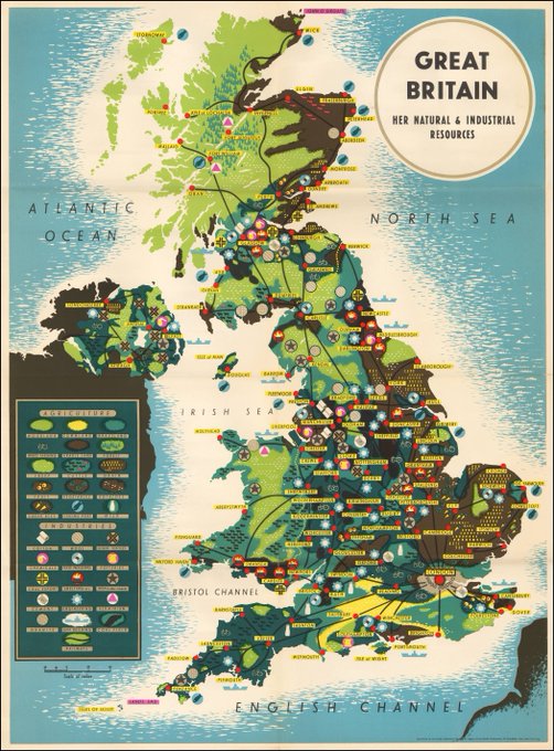
Vintage 1942 #map of resources in #UK looks so hip it could’ve been produced by a hipster designer today. It's a marvelous piece! Source: https://t.co/hcl2ggKugK


Roman geographer Pomponius Mela created this world map (very Rome-centric of course) in about 40 AD. 2000 years later Reddit user CountZapolai overlays modern country borders on the old map. Clever and good fun to look at. Belgium is sooo big! Source: https://t.co/QlEyOzxLMU
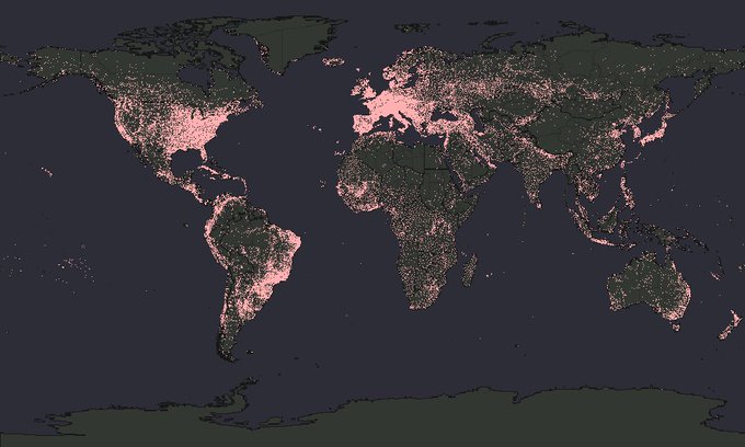
#Map shows all known FM radio transmitters in the world. A proxy for population distribution that overemphasizes regional and remote outposts I’d say. I somehow really like this map. Source: https://t.co/lh7ZY9Livy

#Infographic show the sleeping habits of various animals. #Dolphins put one half of their brain to sleep at a time. #Giraffes almost don't sleep at all. #SeaOtters hold hands while sleeping. Source: https://t.co/6wKV6Z0AOM
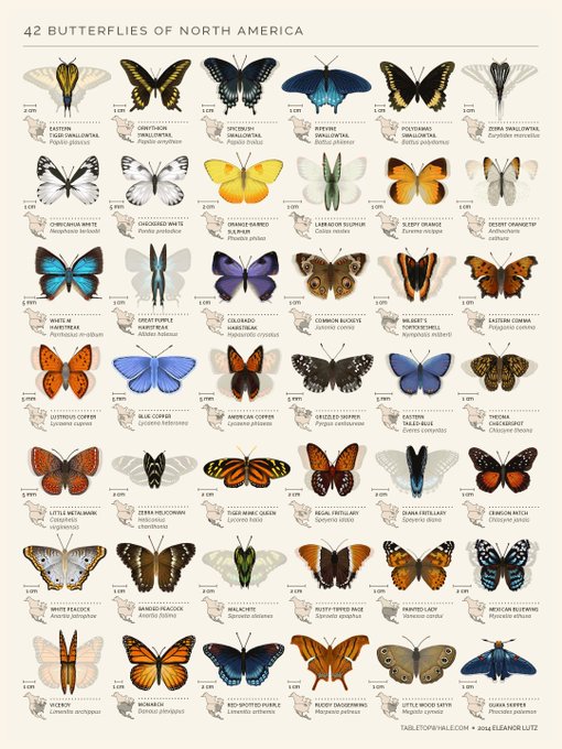
Time to re-share everybody's favorite #butterfly #infographic. Source: https://t.co/TwOcYDd24q
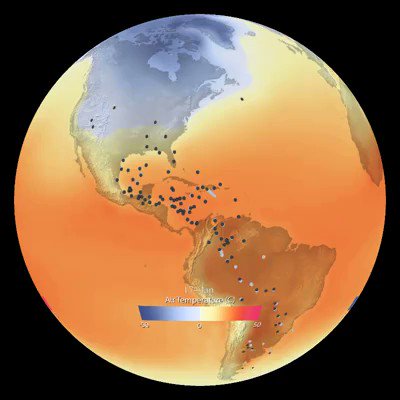
#Map shows #bird migration patterns in the western hemisphere. Beautiful to watch. The article points to https://t.co/6lvEYDyzs8 which is a super cool citizen-science project collecting bird data. Source: https://t.co/n8W9w7MPgL

Oh what a pretty looking graphic! It actually shows the network of these annoying Twitter spam bots that want you to sign up for “Dirty Tinder” or porn websites. The article by @r0zetta exploring these bot networks is super interesting: https://t.co/SghA1lDntZ