
Simon Kuestenmacherさんのイラストまとめ
@simongerman600Follow @simongerman600さんをフォローする
フォロー数:215207 フォロワー数:264446


I found this rather funny: “The map of Holland, but for once, it's actually a map of just Holland.” Holland is a region of the Netherlands and the name often gets used synonymously for the whole nation. Source: https://t.co/Mok1S3IPvt


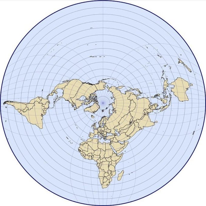
A few days ago I saw the "Hellerick boreal triaxial projection" for the first time. Now it has been given a super nice overhaul. Source: https://t.co/5KFyH45LTZ

You might want to use this #map projection at some stage just to be able to use the term "Hellerick boreal triaxial projection"... Source: https://t.co/HSJUXuVsem

Brief evolution of European armor from 1100 to 1600. Source: https://t.co/vt23BjxgAc

#Map shows major shipping routes in the colonial era by empire. Source: https://t.co/pV7K4KLYJw

Can't wait for this to happen! In only 250 million years our continents will have merged into a single super-continent "Pangaea Proxima". Look at the cute Atlantic! The Himalaya won't be the highest mountain range anymore! Source: https://t.co/Y2wiOpiRNF
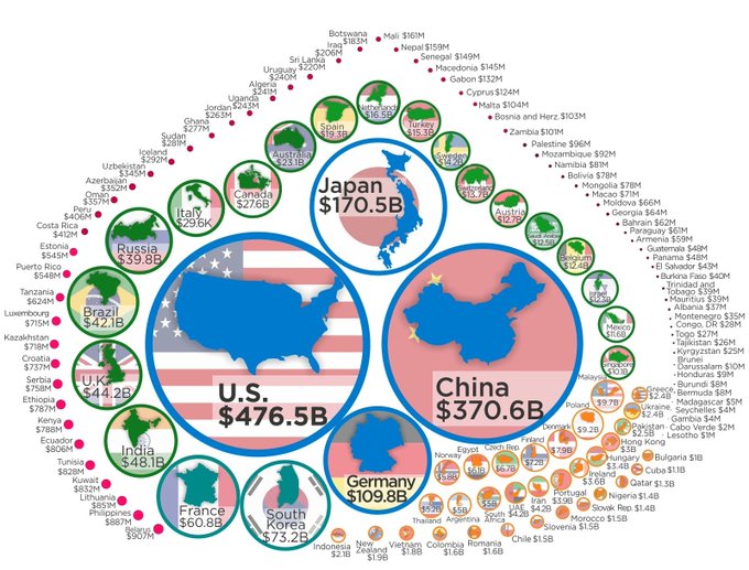
#Dataviz by @howmuch_net shows how much countries spend on Research & Development. This is a very important measure as "knowledge work" becomes increasingly important. The link allows you to download the data by the way... Source: https://t.co/xlvUmQFbUq

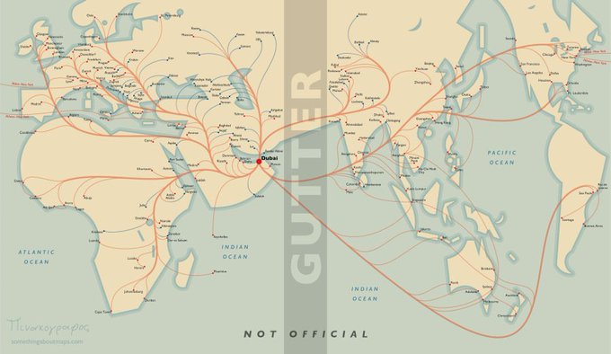
You've seen the flight connection maps in the back of in-flight magazines. This cartographer walks us through his process of putting together a #map like this. Very visual blog post and endlessly fascinating! So many things I didn't consider!
Source: https://t.co/Q4IybRxhr7


Europe after the completion of Herman Sörgel's Atlantropa Project. A hydroelectric dam across the Strait of Gibraltar would provide tons of green energy while lowering the surface of the Mediterranean Sea by up to 200m to make room for settlements. Source: https://t.co/8InJnu5OJw