For 10 runs in a row, the GFS has consistently trended south for the possible snow event in the mid-Atlantic this week. For as much as some have purposely chose to ignore/blast the Euro for being "wrong" because it's not showing the solution they want, the GFS has all but caved.
#Elsa is now a hurricane, having undergone borderline rapid intensification in the last 24 hrs despite moving at 25 kts & facing ~20 kts of shear. Certainly didn't see this coming!
It's also concerning to see some of the really aggressive HWRF runs from yesterday verifying 😬 https://t.co/60kmoAD3A0
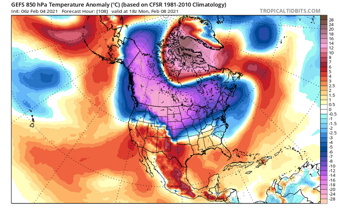
The gigantic arctic air mass that'll be lurking on the CONUS's doorstep next week originated over Siberia in late January.
Siberian express 🚂🚂🚂
Looks like I might be hitting the links for the 2nd Christmas in a row.
⛳️
Womp
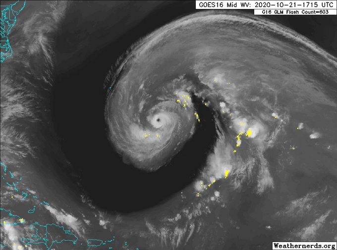
I honestly think it's pretty insane to see a major hurricane superimposed directly underneath a large-scale upper trough. Gotta love tropical transition!
#Epsilon
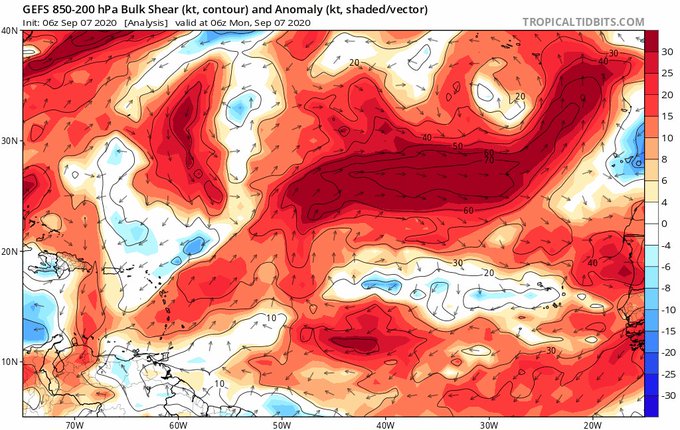
A theme that's continued today is the idea that the further west #Laura gets in the near-term, the more it intensifies in the Gulf. #Laura being further west brings it closer to the center of the ridge axis to its NW sooner, less wind shear over the storm >>> more intensification https://t.co/k9yfKyn62h
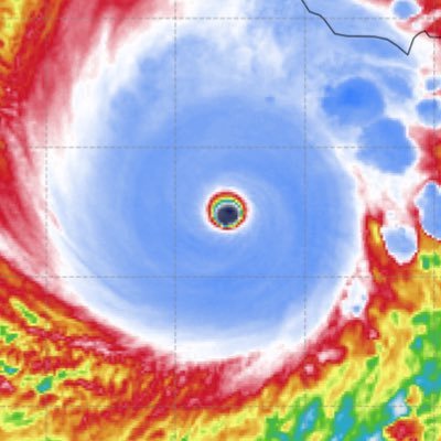
Wow, didn’t realize that Gulf coast major hurricane landfalls were buy one get one free this month.
🌭🌭🌭
The new NMME forecast paints a pretty grim picture for the tropical Atlantic during the peak of this year's hurricane season. Corroborating recent seasonal forecast updates from CSU & NOAA, the tropical Atlantic looks poised to be very active. Buckle up
#Tropics #HurricaneSeason


