AntiqueMapsのTwitterイラスト検索結果。 4 件


Historical Vintage Map Reproductions. https://t.co/4iPDScYTAI
===
#antiquemaps #wallart #maps #reproductions #vintage #art #historical #AYearForArt #travel #tourism #artprints #homedecorideas #giftideas


Some lovely antique prints of Italy. Oh how we miss beautiful Italy!
#italy🇮🇹 #italy #italytravel #italygram #italyiloveyou #italy❤️ #antiquemaps #antiquemapsandprints #antiqueprintsforsale #antiqueprints #rareprints #italia #italien


Our virtual booth at the online #ParisMapFair is open for business! Find out more about this beautiful #frontispiece (and many other interesting #cartographic items) here:
https://t.co/2qHafJx8Sy
#atlas #maps #mapfair #antiquemaps #virtualmapfair #map #antiqueglobe #rarebooks

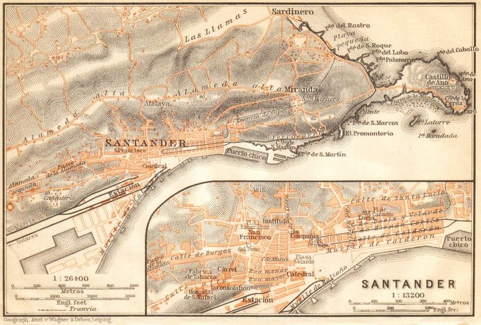
#14September #September14 #14Septiembre #14Settembre 2020
Santander y alrededores (1899) 🇪🇸
via mapas.owj
#Santander #Cantabria #Spain #España #mapas #maps #mapmonday #vintagemaps #ancientmaps #antiquemaps #cartography