LandsatのTwitterイラスト検索結果。 75 件


Countdown to @FOXTV ‘s 9-1-1: Lone Star (@911LoneStar / #911LoneStar ) Season Four: 3 Days!
Next up in the character countdown portraits is Paul Strickland played by Brian Michael Smith (@TheBrianMichael /#brianmichaelsmith )
#stricklandsaturday


Inventor of 3D Images
VALERIE THOMAS
Invented the Illusion Transmitter
- Scientist & Inventor
- Managed images processing systems for NASA's "Landsat"- the first satellite to send images from space
- Today she presides over her regional chapter of Shades of Blue
#Nerdvember


2000年頃から国際枠組みでデータ無償化が議論されていましたが、2008年にUSGUのBarbara RyanとNASAのMichael FreilichがLandsatのデータ無償化を決め、その後打ち上げられたSentinel衛星も後を追いました。
なお、故Michael Freilichは、Sentinel-6の別名にもなっています。
https://t.co/lzYdOYZVBR

1999年打ち上げのLandsat7のデータは84千円でした。同じ年に高分解能の商業衛星IKONOSが打ち上げられ、30m分解能のLandsatは値下げせざるを得ない状況でした。
Landsat7は2003年にセンサの一部が故障し、不完全なデータで提供を継続することになったのですが、その際に価格も下げられました。


現在、Landsat や Sentinel の #衛星画像 は無料で利用することができますが、1980年代はLandsatのデータが約30万円で販売されていました。
2008年の無償化までの約30年の歴史を4コマ漫画風に振り返ります。

I have a mess of half finished drawings so I finished up this one this evening. So I guess happy #StricklandSaturday
@TheBrianMichael 😂🤷🏼♀️
💙🤟🏼
#brianmichaelsmith #paulstrickland #911lonestar


#SavageLandSaturday by FredianOffical @UncontrolMarie


Who knew microscopic plants could be so pretty😍
This image acquired by #Landsat 8 shows colorful swirls of suspended sediments & phytoplankton along the shores of the Manitoba Great Lakes!
Learn more about the formation of Canada's green-hued wetlands: https://t.co/bsWEmi14UT


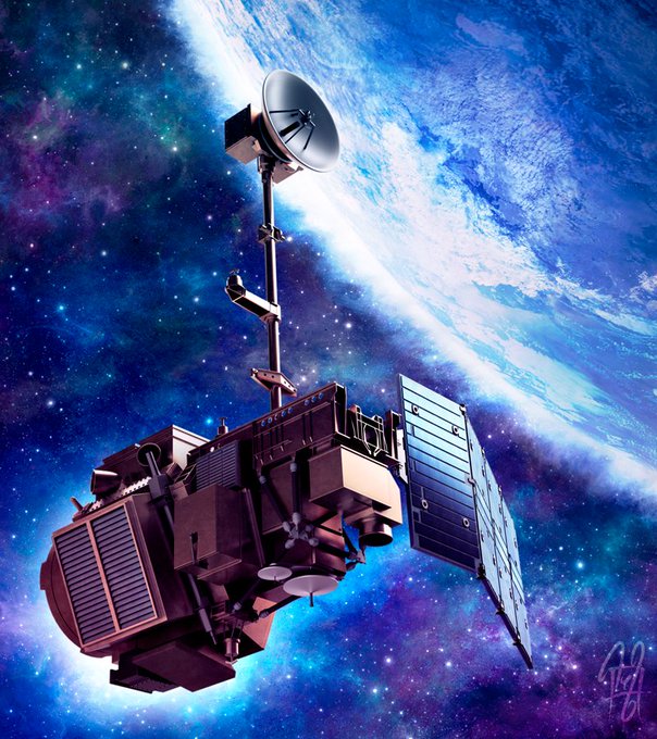
Re-sharing an old illustration I did of the Landsat 5 in celebration of NASA releasing the first image taken by Landsat 9 🛰️
I also recently rewatched Kong: Skull Island where Monarch piggy-backed on a Landsat mission, so I guess you can say I've had it on my mind lately, lol!


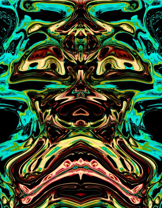
#NASA wants to see your Landsat satellite-inspired artwork. A #landsatcraft image (left) of a late-summer phytoplankton bloom swirling in the Baltic Sea. My #digitalart work (right) is titled, Bowser.
@NASA_Landsat


Planet(前ツイ)は3m解像度なので余裕で見える。300m解像度のSentinel-3(左図・昨日)ではまず見えない(言われるとうっすらとなんかあるかも)。30m解像度のLandsat(右図・本日)だとよくよく見ると島の周辺や雲の合間にちらほら見える。

#NASA wants to see your Landsat satellite-inspired artwork. A #landsatcraft image of the sands and seaweed in the Bahamas. My #digitalart work is titled Bahamian Water Idol in the Sand. @NASA

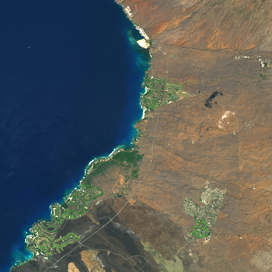
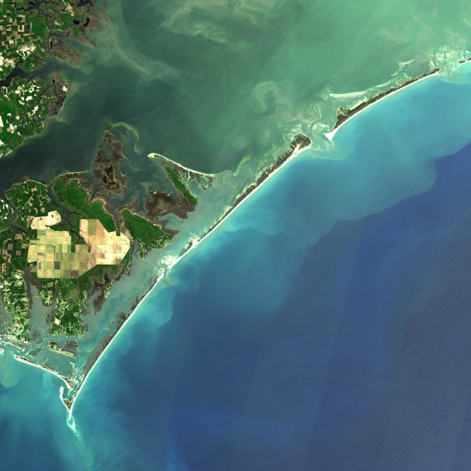
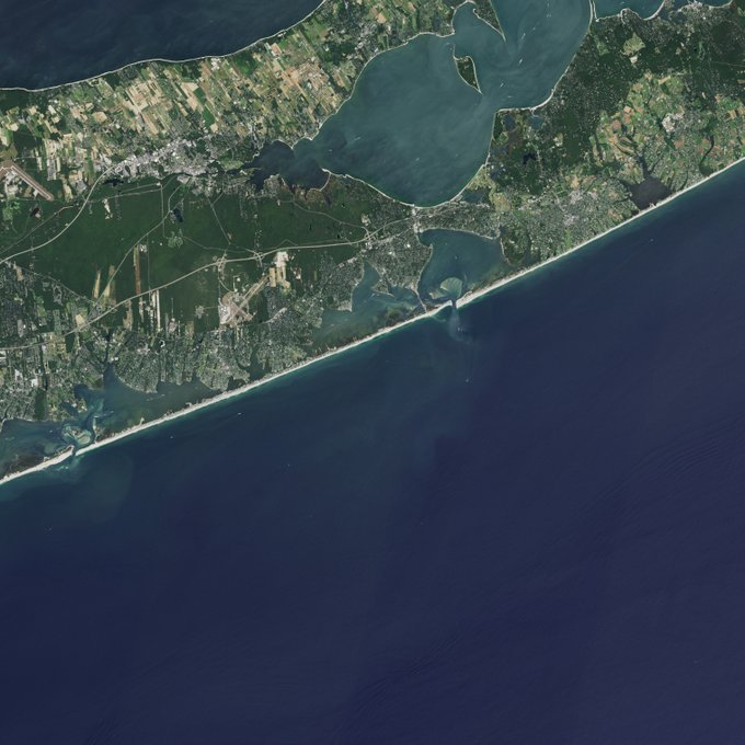
☀️ Summer is in full swing! ☀️
To celebrate the launch of @NASAEarth’s Landsat 9 satellite this fall, we worked with Dr. Beach to tour 2021's top U.S. beaches as seen by @NASA_Landsat.
Did your favorite make this list ➡️ https://t.co/Q9T25ZojUI


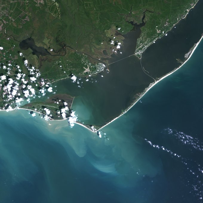
In the southernmost reaches of Burma (Myanmar), along the border with Thailand, lies the Mergui Archipelago. The archipelago in the Andaman Sea is made up of more than 800 islands surrounded by extensive coral reefs [Landsat 5, Michaeal Taylor: https://t.co/038j9CL5Ta]

#SavageLandSaturday by Rafaschneider2016art @UncontrolMarie

#SavageLandSaturday
by CValenzula
@UncontrolMarie 💛💥💚

#SavagelandSaturday by EBas/CopicMakers @UncontrolMarie

In the southernmost reaches of Burma (Myanmar), along the border with Thailand, lies the Mergui Archipelago. The archipelago in the Andaman Sea is made up of more than 800 islands surrounded by extensive coral reefs [Landsat 5, Michaeal Taylor: https://t.co/038j9CL5Ta]