MapMondayのTwitterイラスト検索結果。 17 件
It's #MapMonday! Today we're looking at "A plan of the farm call'd Betwells and Holly-Bush-Hall, 1772", with each Parish divided by the road to #StAlbans and #Hatfield. We love the vibrancy of the colours which are still apparent after all these years. #maps #history #archives
For #MapMonday this week we have 'Carte géologique et topographique du Mont Vésuve' (1838) by French geologist and mineralogist Ours-Pierre-Armand Petit-Dufrénoy 🌋🇮🇹
Find out more https://t.co/xQi5s16SPC
#MedMonday #Mediterranean #Geology #Italy #Map #Naples #Vesuvius #Volcano
For #MapMonday we have PM 226, a plan of Aldwick, Bognor and Felpham dating from around 1937, when a proposed bypass was in the works. The map features specific sites that a tourist may be interested in, such as Cragiwell House 🏠 or - more importantly - the bowls green. 🏐
It's #FreeMapMonday! Retweet and follow us for a chance to win the map of the Seismicity of Hawaii!
#USGSStore (U.S. residents only)
We were flipping through the mammoth tome Orchidaceae this morning and found a trifecta of interesting content for #MapMonday, #InternationalWomensDay, and #SciArt.
Cirrhopetalum umbellatum is pictured, underlaid by a map showing regions of the world where it grows. [1/4]
🎄Looking for gift ideas?🎁 Prints of beautiful geological maps from our collections can be ordered in a range of sizes and finishes from our Picture Library: https://t.co/VZFjB6UoNm Order by 18/12 UK, 11/12 overseas for Christmas delivery! #MapMonday #christmaspresents #geology
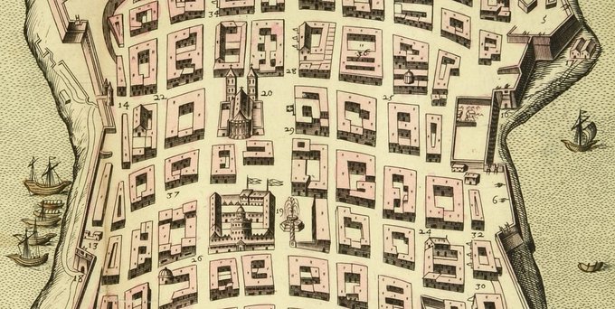
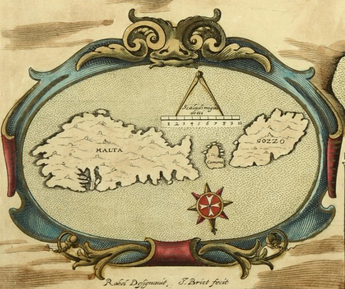
V is for Valletta, capital city of Malta. This map probably dates from the late 1630s / early 1640s & is part of a volume of C17th European town plans. #ArchiveZ #MapMonday
@UkNatArchives 📁 WO 78/5816, f 255 https://t.co/ADs9CwLFyv
#14September #September14 #14Septiembre #14Settembre 2020
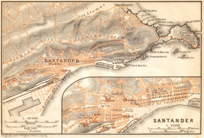
Santander y alrededores (1899) 🇪🇸
via mapas.owj
#Santander #Cantabria #Spain #España #mapas #maps #mapmonday #vintagemaps #ancientmaps #antiquemaps #cartography
Made a #map for my friend's #cyberpunk #ttrpg called Rings of Earth. The Earth has suffered intense flooding and land destruction from swarms of nanites. Most people live in orbit, whilst what's left of Earth is fought over or full of gestalt gribblies. #MapMonday #scifiart #rpg
Below is an image from the UFDC World Map Collection of the Northern Hemisphere that was published in 1817.
The Northern Hemisphere has more land, pollution, and around 90% of the world's population.
#MapMondays #DigitalLibrary #UFSpecialCollections
Thousand Week Reich - Operation Flood 1959, Remastered by AP246 #MapMonday Via: https://t.co/wrPbSOBERf
B is for Busy Beavers on Herman Moll's 1715 map of British colonial territory in North America.
@UKNatArchives 📂 WO 78/419/8 https://t.co/5CfHSVWkyc
#ArchiveZ #ExploreYourArchive #ArchiveAnimals #MapMonday
The Tejan and Aztlan Revolutions of 2089-2091 by Prince di Corsica #MapMonday Via: https://t.co/o2gPX2F72v
#MapMonday equals another gem for you: Add Mss 28784 - a 1631 map of Cuckfield, Lindfield and Wivelsfield - is beautifully detailed, including an acorn & rose border, open books with readable text, & the pedigree of the Hardham family going back 5 generations. #ExploreYourArchive
#FolioFeatured A nice festive #MapMonday with this artwork @studioMUTI of Skiing resorts in Switzerland
https://t.co/HfccHukTKN
In April 1907 General William Booth embarked upon a 25, 361 mile long campaign through Canada & the Middle East! #MapMonday
#FolioFeatured Monday morning’s are busy – however you’re travelling! Artwork by @PGreenwoodDraws this #MapMonday
https://t.co/VWzOPl4tbp


