NDVIのTwitterイラスト検索結果。 7 件
🔴Check some cool examples on how to fuse various satellite missions' data to look through clouds, generate NDVI from SAR, pan-sharpen daily Sentinel-3 imagery with weekly Sentinel-2 and more.
As usual, all processing scripts are open-source.
https://t.co/9QGUStwIQG
今日も1日お疲れ様でした😌
こちらは「#しきさい(#GCOM-C)」が観測した2019年9月の #植生指数(#NDVI)と #クロロフィル α濃度です☘
医療従事者・関係者の方々、
新型コロナウイルスと日々戦っている全ての方々、
#今日もありがとう ございます。
🇧🇴 Bolivia | Multi-temporal #NDVI image of agricultural plots, processed in @sentinel_hub using @HarelDan
custom script. [ No additional editing ] Take-2
#EarthPaintings | #EarthArt | #EarthAsArt | #Sentinart | #Psytinel
🇧🇴 Bolivia | Multi-temporal #NDVI image of agricultural plots, processed in @sentinel_hub using @HarelDan
custom script. [ No additional editing ]
#EarthPaintings | #EarthArt | #EarthAsArt | #Sentinart | #Psytinel
🇧🇴 Bolivia | Multi-temporal #NDVI image of agricultural plots, processed in @sentinel_hub using @HarelDan custom script. [ No additional editing ]
#EarthPaintings | #EarthArt | #EarthAsArt | #Psytinel | #Sentinart
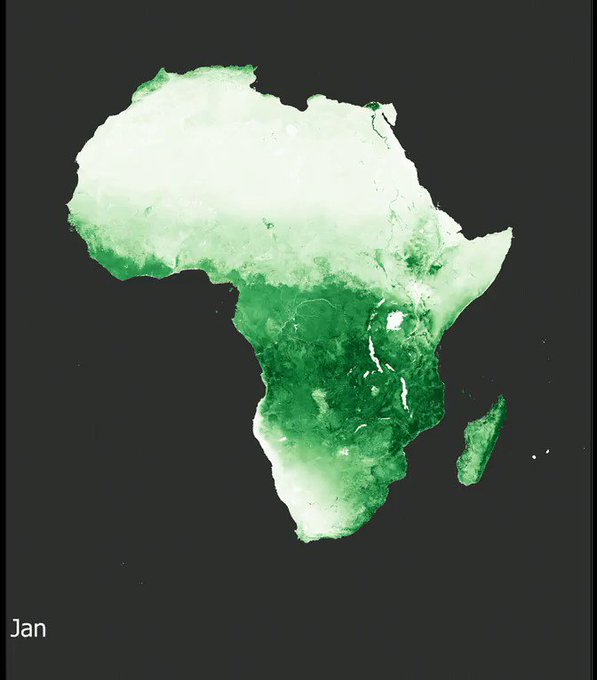
An impressive visualization of the vegetation intensity variations in Africa during a solar year https://t.co/ehTi7zft3J [more info about the Normalized Difference Vegetation Index (NDVI) https://t.co/mtgmvXZS8m] [data source: https://t.co/RyV1eBI9WM]
Hurst Spit is a barrier to a salt marsh. For our @channelcoast project we flew the UAV with the Sequoia camera. Here is the NDVI result


