OpenStreetMapのTwitterイラスト検索結果(古い順)。 21 件


Tsurugajo castle park 360 photomapping completed. Map: Chiriintizu, App: Kashmir #OpenStreetMap #SotM


New Project: Flights to Rome #flights2rome. A data visualization of the entire global 🚗 and ✈️ mobility network.
→ https://t.co/c5pYhfHD7q
w/ @st_phan @moovelLab @HerwigScherabon @whatsuprapha @tibbb Data: @flightradar24 and #OpenStreetMap


#podcastoftheday
Listen to Andy Allan (@gravitystorm), cartographer and the creator of OpenCycleMap as the talks about how he got involved with the OpenStreetMap project and ended up creating activity-specific maps at a global scale
https://t.co/yXErgf1NCs


サムライせんせい最新話『在りし日』更新されました
武市先生、竜馬の江戸の思い出
お読み頂けると幸いです🤲
https://t.co/xF6Hn32mCJ
地図は©OpenStreetMap contributorsよりhttps://t.co/NYxR62SYR7


Two new countries available on Osmose-QA! We was think we cover the whole world. Now San Marino and Vatican City are also available. #OpenStreetMap https://t.co/ixMKOgHcSG


大阪府の道路(OpenStreetMapのデータ)をCity Roads(https://t.co/ruZKVnX116)より出力
道路の疎密具合から、三方(北・東・南)が山(北摂山地、生駒山地、金剛山地、和泉山脈)に囲まれている様子が浮かび上がってくる


葉山町でハイキングして、はやま三ヶ岡山緑地の地図を作成。あじさいコースはたぶん間違ってる(地理院地図の間違い)。
葉山町は山と街が近接・混在している感じが面白いよね。
((C)OpenStreetMap contributors)


#30DayMapChallenge Day 2: lines
I used data from @WFP and #QGIS to visualise global railways. I think the data comes from OpenStreetMap, the American Digital Cartography and Global Discovery.
More info in https://t.co/3MNh9EKe0r


#30DayMapChallenge day 3 – polygons.
Voronoi polygons showing the nearest (linear distance) tube station for each point in London.
Data: ©OpenStreetMap contributors
Tool: QGIS


New administrative divisions of Ukraine after 2020
#30DayMapChallenge Day 15: Connections
#QGIS Data: #OpenStreetMap contributors, personal


🎨 I mapped my neighbordhood in the style of an artist
👉Can you guess who❓
🔴No SVG
🎁Only OSM Data
🌟Only Geometry Generators (and @qgis)
Location : https://t.co/auHtgw1moj
#OpenStreetMap #madewithqgis #gischat #QGIS #cartography


Complex hipped roofs are now supported by Blender-OSM addon. The addon successfully treats 99.99% of hipped roofs in OpenStreetMap. The feature is currently available in the experimental mode of the premium version. Update of assets is also required. #b3d


#SotM2021 Posters are now up on our website!
Check out: https://t.co/cpitdG9Luh to view the poster exhibits!
#StateoftheMap #SotM #posters #cartorgraphy #mapping #openstreetmap

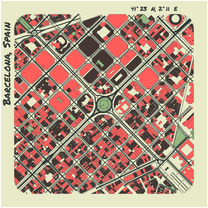


A minimal Python library to draw customized maps from OpenStreetMap data https://t.co/KvdRW1NusB by @marceloprates_


Automatically creating really pretty maps using Python and OpenStreetMaps data: https://t.co/Si8ntaIk3t


marceloprates/prettymaps: A small set of Python functions to draw pretty maps from OpenStreetMap data. Based on osmnx, matplotlib and shapely libraries. https://t.co/6sqamqBJAY


OSM art is awesome art! This one uses the prettymaps Python library by @marceloprates_ that's based on osmnx, matplotlib, shapely and vsketch libraries.
Learn more about prettymaps at: https://t.co/KeKOIG2tP8
#openstreetmap #osm #art #osmart #python #prettymaps #opensource


Prettymaps: #Python library for customized maps from #OpenStreetMap data
https://t.co/O2TEjX7hA1
v/ @SourabhSKatoch
#DataScience #BigData #Analytics #AI #MachineLearning #IoT #IoTPL #RStats #Serverless #programming #coding #100DaysOfCode #DEVCommunity #CodeNewbie #WomenWhoCode https://t.co/NKL0BDA0Js


#30DayMapChallenge day 5 - OpenStreetMap!
I map a heatmap of Chinese restaurants in NYC. restaurant data extracted from @openstreetmap via the Overpass API, mapped in @LeafletJS w/ the Leaflet.heat plugin. tiles are @StadiaMaps