QGISのTwitterイラスト検索結果。 44 件

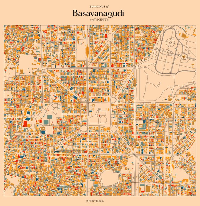


Map art with building footprints of some areas in Bangalore. #QGIS


🗺️A Map Showing Terrain Model of Mt.Rainier 🏔️( Pierce County, Washington, U.S🇺🇸) Data source from @OpenTopography (USGS10m) #MtRainier #gischat #cartography #dataviz #QGIS #Blender3d #DataVisualization #Geospatial


Why would I, the #rayverse's number one fan, use Python? :P Because I wanted to play with the cool {riverrem} package by @OpenTopography! And it is very cool indeed. What's more, it is fast, faster than if I did this in QGIS.
And I used RStudio of course! Yay {reticulate}!


#Satellite #photography of
#NorthSea Isle of #Spiekeroog
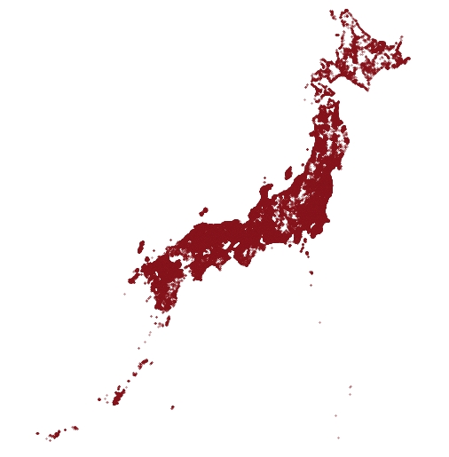
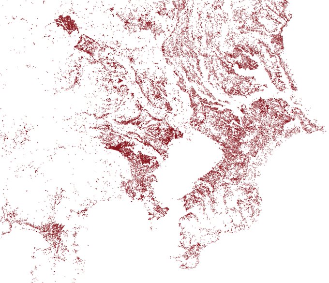
False color urban layer 2022 - Red urban areas
#Sentinel2 #Copernicus #remotesensing
@sentinel_hub
@CopernicusEU
@CopernicusLand
#QGIS #OpenData #EarthArt #EarthObservation #DataScience #dataviz #OpenScience


Elevation data from part of the Chugach Mountains, Alaska. Data from https://t.co/Hk5VXyo5Su #rayshader #QGIS #RStats


Why have I been hard at work on the topography? For a commission, of course! This is what I've got going on now. Fist island! Probably monks live here or something. Heavily using QGis for this one! #cartography


#30DayMapChallenge Day 24: Historical map.
Very quick map of Middle Haast from NZ Heritage Maps. Historic map draped over relief shading. Made using QGIS and GIMP.
Data from:
https://t.co/HJ8GKepDNW
https://t.co/8BiG8wXYwc

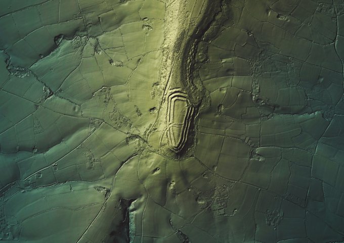

#30DayMapChallenge - 17 and #HillfortsWednesday in one today😉. Render of the impressive #Neolithic/ #IA #enclosure of #Hembury (on the edge of the #BlackdownHills in #EastDevon) and surrounding landscape from @EnvAgencyGeomat #LiDAR > #QGIS & #GIMP. #Hillfort photos below 1/n >


Have I figured out how to do hillshading on Illustrator from QGIS?
Why yes. Yes I have.

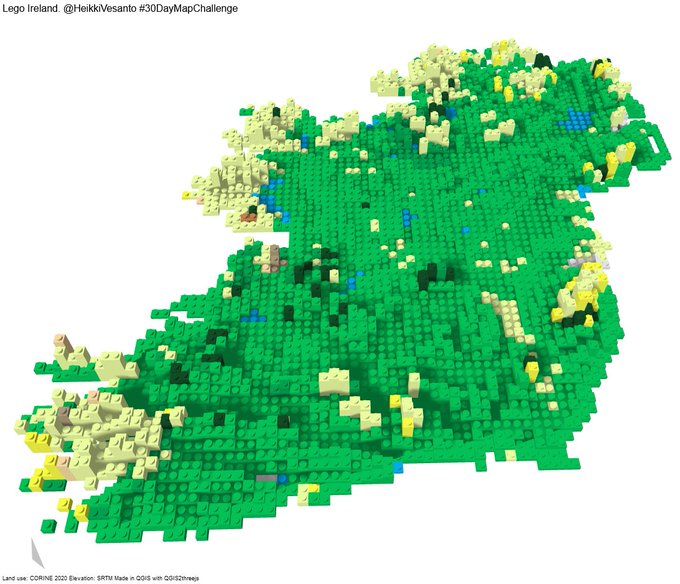
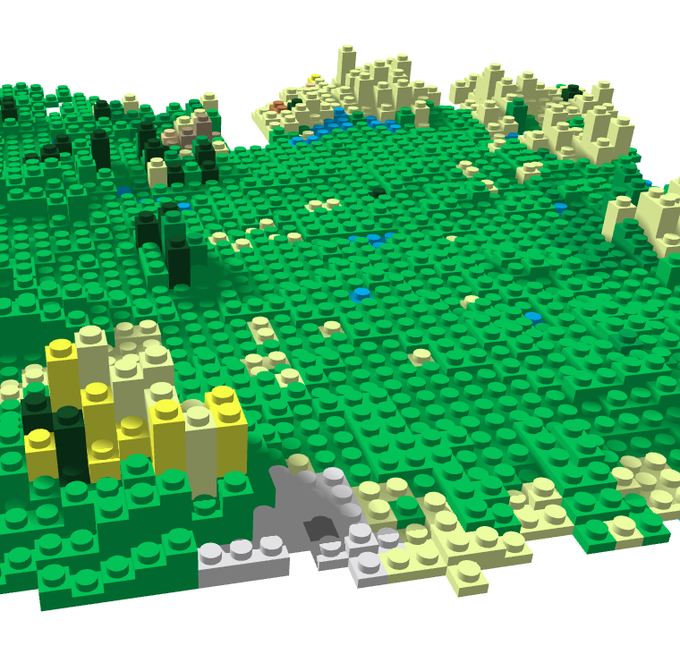

#30DayMapChallenge Day 11 "3D" - Lego Ireland
Created in #QGIS with QGIS2threejs.
Interactive: https://t.co/6nKNceVSAT
Elevation from SRTM and land use from CORINE.


[QGIS用GeoTIFF] GEBCO2020から全世界カバーするベースマップ生成してみました。CC-BY。 https://t.co/YXgj41xJdQ


I've been playing around with some DSM data in #QGIS. (Arthur's Seat, Edinburgh) Amazing what you can do without needing to extra software. It's great to combine the results of a GDAL Hillshade with "edges" & the results of the Batch Hillshader plugin. Then come the blend modes!


Vaporoads
Sénas, data @IGNFrance BDTOPO
#QGIS #latenightexperiments