ecmwfのTwitterイラスト検索結果。 77 件


You better be kidding me about this one. The new ECMWF weeklies are out and they show above-normal precipitation totals possibly into early April. This would mean March could have very few rain-free days.
#CAwx #AtmosphericRiver #wxtwitter #PineappleExpress2023


24、25日の寒気
ECMWF予報はトーンダウン:
最新初期値の予報では、850hPaの-16℃線が九州北部にかかることもなくなり、この通りなら、850気温の記録更新は無さそうです。でも東日本、西日本の大部分が-12℃以下になることは変わっておらず、警戒は必要です。

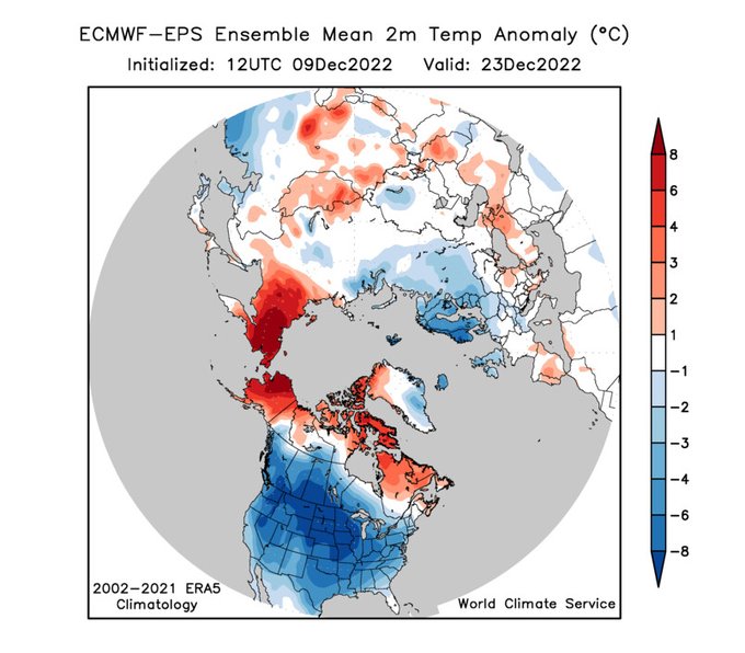

Coast-to-coast U.S. cold leading up to Christmas: an extremely impressive ECMWF ensemble-mean signal at day 14. Big shift towards prolonged -AO blocking in the 12Z run today. Wow!


In de nieuwe setting van ECMWF vanaf 7 december het echte werk met een kou-inval vanuit het noordoosten!❄️ Afwachten..
#sneeuw #koud https://t.co/knEFlgc8nN


WOW, the latest updated ECMWF model mean is looking quite incredible this evening for early December; look at all that blocking high pressure to the N around #Greenland to N Scandinavia! #Europe has never been so set up for winter weather! #Winteriscoming 1/2


Weather models showing very unsettled spell of weather over next 7 days with risk of stormy conditions and heavy rain. One model (ECMWF) showing over 100mm over the 7 days and also risk of strong winds around Monday night/Tuesday. Those in areas prone to flooding be aware.


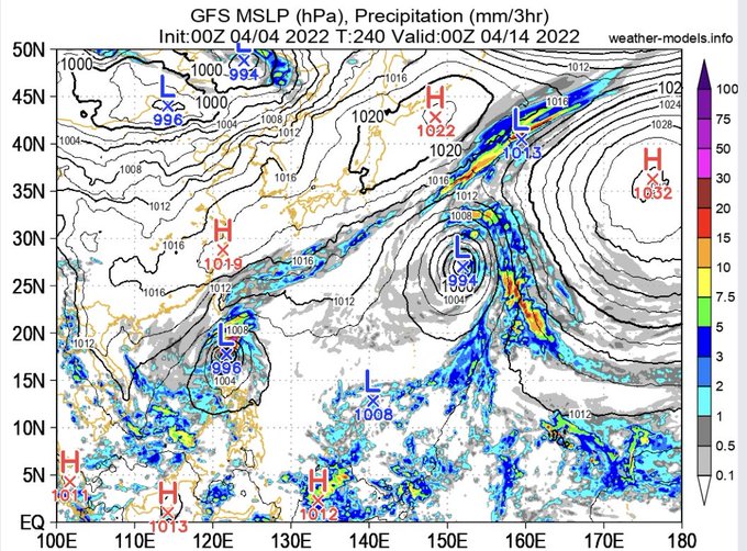
[Thread] Au-dessus d'un mer anormalement chaude, le modèle ECMWF voit la formation ce week-end d'un cyclone tropical à 39° de latitude N. Ca donne des images assez inhabituelles. Au-delà de l'effet buzz, est-ce remarquable ? Est-ce que l'Europe sera concernée par un cyclone ? 👇


🌡️Outre les températures potentiellement exceptionnelles attendues la semaine prochaine, la #canicule pourrait s'inscrire dans la durée et perdurer au-delà du 18/19 juillet. Une situation qui pourrait s'avérer inquiétante.
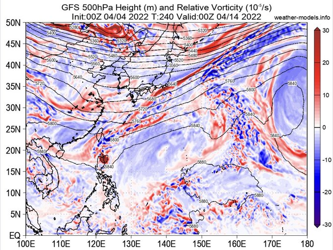
Animation : Anomalies de T°C à 850 hPa - ECMWF


ECMWF est maintenant raccord avec les autres modèles phares jusqu'à samedi prochain. #Canicule assurée pour pas mal de régions entre mardi et samedi. Cela commencera plus tôt bien sur par le sud et le sud-ouest. Les cartes de températures sont effrayantes !


今年の冬の鬼門は12月頭だったなぁ。各国季節予報モデルは極渦を強化し、冬の後半は世界規模の暖冬を予想。確かに当たっている感じだけど、日本付近は気温の上方修正が裏目に出ました。
そんな中、日本の気象庁はきちんと低温予想を出していたのがすごいです。
※図はECMWFより