HarvardMapCollectionさんのイラストまとめ
@HarvardMapCollFollow @HarvardMapCollさんをフォローする
フォロー数:787 フォロワー数:8870


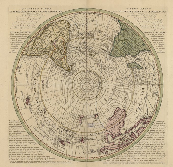
From the polar antipodes to the equator, 2 maps by van Ewyk, using isogonic lines to display the variation of the compass, "or the marvelous concatenated accord of regulated & never-ending movements of the living magnetic power; as we found them in 1750." #maps #HarvardLibrary

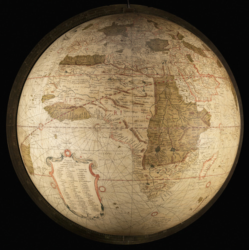
From Ptolemy's 2nd c. to Beatus' 8th c. (here in a 1929 facsimile by Konrad Miller). The tripartite world is encircled with water; East, where Paradise lay, is at the top of the #mappamundi; the Red Sea unmistakable in the South. A spatial-temporal worldview #maps #HarvardLibrary
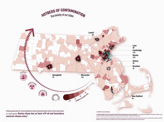

Check out the @bplmaps exhibition, esp the great "Same Data, Different Stories." They asked cartographers to make 2 conflicting #maps from the same data set. Maggie Owens of @BostonPlans shows #ma hazardous sites as raw # and then normalized by population. https://t.co/Uztjq4z4i5
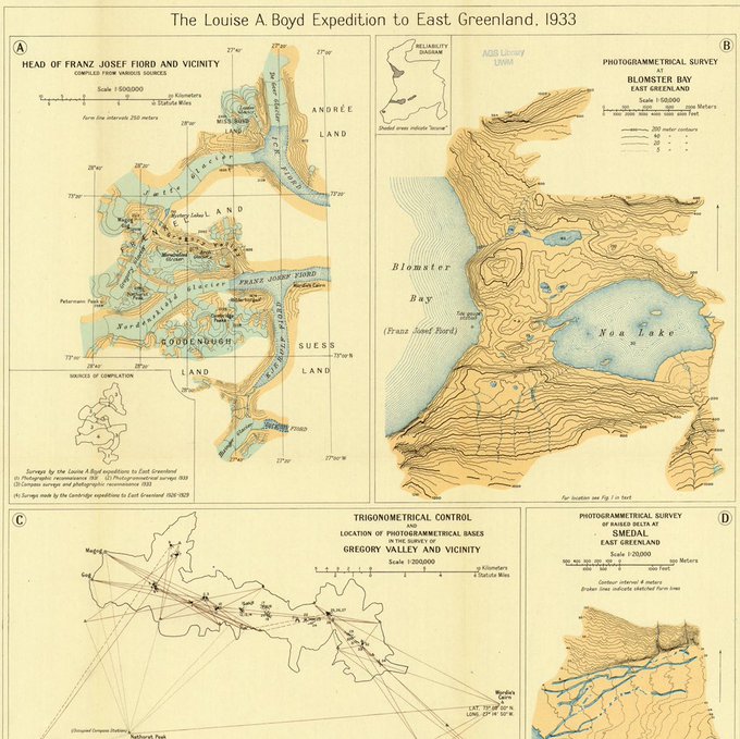
Here, a 1933 #map for Boyd's work in Greenland. Learn more at @AGSLib's interactive map of Boyd's 1931 expedition, https://t.co/McLexoauOj #maptimenotnaptime

Mapire wraps up a week of digital resources, combining incredible georeferenced surveys of #Europe with #maps overlaid on digital elevation data. #Brezo looking north from 2nd military survey of Habsburg Empire (Franziszeische Landesaufnahme, 1806-1869) https://t.co/2A0d6lN4fc

A day late for #outofthisworld #wednesdaychallenge but I'm excited to do some printing in outer space! From Samuel M'Cullough's 1840, 8 sheet #map of the visible heavens. #harvardlibrary

For #WorldOceanDay and #libraryloveisloveislove, here's a #blue #map of the ocean around #Antarctica. It was published in 1898 to show "John Murray's proposed scheme for Antarctic exploration." #oceans #ocean #prideweek #HarvardLibrary