Well......it is the peak of the season for a reason. The Gulf one bears watching most.
Seriously.....look at this still rapidly intensifying beast that is #HurricaneLaura . It is crazy!
I mean this has been strengthening so fast. Cat 3 115mph....this will get to a cat 4 and likely over 140 mph. That structure and outflow is perfect. Look at that eye. :0
Been so busy at work last 8 hrs I haven't been able to check on #hurricaneIsaias .
That is looking pretty damn organized again and that eye is apparently a pin point eye. Very small. Still more Northeast dominate but back up to 80mph. :O
Will take a bit tonight for #Isaias to get going again fully but the structure is clearly there for it to go. It's trying to get that classic comma shape to full wrap up but just as a little bit of dry air it's fighting right now on the West side. The core is very much alive.
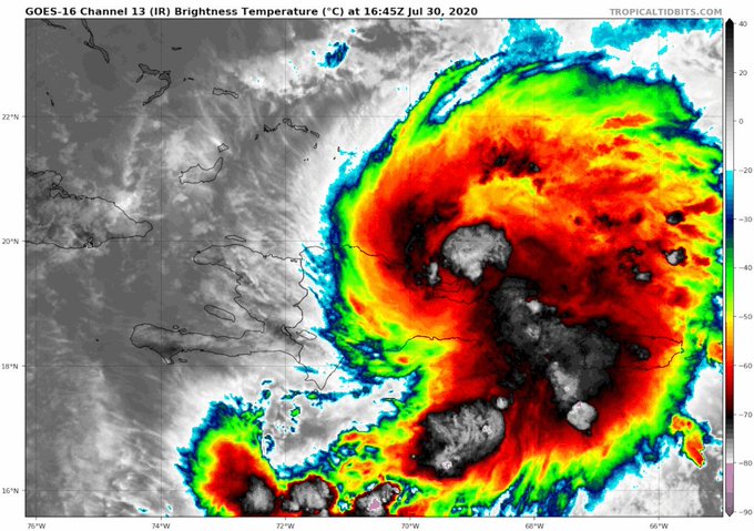
Very interesting look at #Isaias . It's trying to comma up slightly right now but it's fully back over water and look at the huge explosion of storms off the East of the center. Just a matter of when that curls around now and the storm can go. 100% will be a hurricane.
Gonna be interesting now that Tropical storm #Isaias is finally now formed. If that can survive Hispaniola there is a chance if this can fight off the shear in the Bahamas this could be a significant hurricane. Models been trending to more of a stronger solution and storm Sat.
I am gonna be one sad SOB if storms don't happen in Albany tomorrow. The parameters are there for some big windy stuff to roll though.
If it's not in Albany I may jog North a little into Clifton Park to film. I only have one good spot there these days I know that is prime.
OK this actually might work out because in a weird way Clayton New Mexico in Boise City Oklahoma are pretty much gonna be right in the target for some super cells to form so unbelievably I will be chasing today... that is awesome for my final true day out here. 5pm is my limit.


