MODERATE RISK including 10% tornado probs issued by @NWSSPC for tonight from western IA through southeastern MN into west-central WI, and it’s December 15. Storm chase mode activated
EXPANSIVE low-level jet (LLJ) will be ripping over 25 states on Friday night! This massive LLJ is due to a closed low off Baja California that ejects around the base of the parent trough and northeast as a large jet streak, carving out an unusually large warm sector
LIVE CHAT on strong tornado threat tomorrow PM from southwest into central Oklahoma, including the OKC Metro https://t.co/hEXFdIWWA8
Time to prep those severe weather safety plans Oklahomans! You know what to do
BATTLE OF THE BORDER! The 3 km NAM shows the tornado threat focusing in northeast MT into northwest ND south of Canada Border with farther south track and more compact surface low structure, whereas the dam HRRR shows the tornado threat just on the SK side with elongated low.
Monster supercell with large hail up to golf balls is crossing I70 just east of Goodland, KS! This storm is moving almost due south. Damaging winds are also possible. Tracking on the @RadarOmega_WX app #kswx
HONDO, TX! Take cover immediately. Dangerous #tornado warned supercell is heading your way! A tornado has been observed. This storm is heading toward San Antonio @RadarOmega_WX
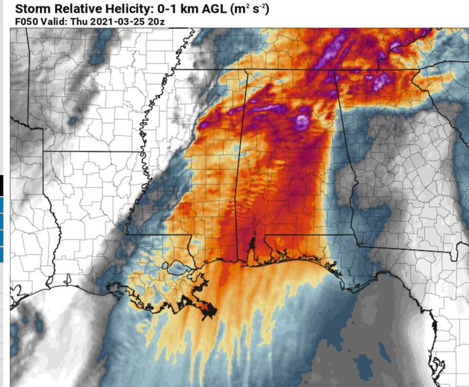
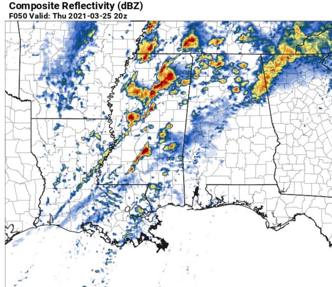
18z high-res NAM doubles down on the tornado outbreak potential across multiple states in Dixie Alley on Thursday, including eastern LA, much of MS/AL and possibly TN. Maxed out ingredients for long track supercells capable of dropping strong/violent tornadoes. @RadarOmega_WX
RAP model forecast for 20z (2 pm CST) shows best collocation of surface based instability and low-level wind shear over Southeast TX. Tornado watch already issued including Houston area. #txwx
EVIL-looking satellite image with #HurricaneLaura this morning undergoing textbook rapid intensification into a Category 4 storm on approach to far southwest LA/Sabine Pass area tonight. We plan to intercept this in Dominator Fore and the HERV, racing drone. @RadarOmega_WX
SIGNIFICANT SEVERE WEATHER possible once again in DIXIE ALLEY this Sunday, April 19, 2020 with another upper wave with strong flow east-side loaded. A surface low will track from E TX through central MS/AL with heightned low-level jet. Tornadoes possible. @RadarOmega_WX


