
NLS Map Collectionsさんのイラストまとめ
@natlibscotmapsFollow @natlibscotmapsさんをフォローする
フォロー数:1134 フォロワー数:16168


@ThingsWork What the world looks like before it’s pasted onto a globe... This example of globe gores is from c.1923. Zoom in at https://t.co/pKBAEHftrj

James VI of #Scotland was born #OTD 1566. See portraits of him and his family on John Speed's map of Scotland, 1610. https://t.co/qEx2GVSOQR
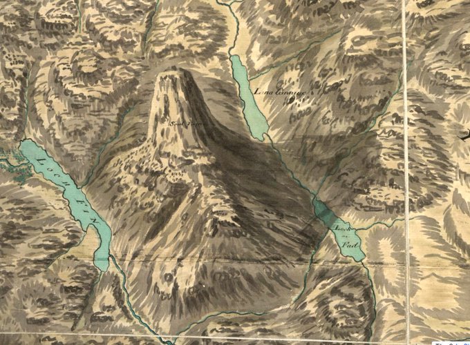
How awesome does #Suilven look on William Roy's 18th century #map...
The #mountain's in the news because of path repair work, with visitor numbers expected to increase following a starring role in the film #Edie. https://t.co/mVCnUVN4SC
See Roy's map at https://t.co/UW97YPo419
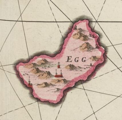
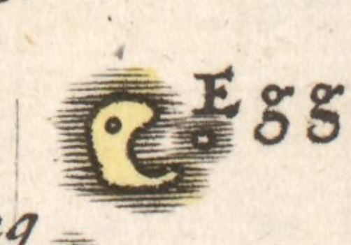


Hope the #EasterBunny brings you lots of colourful eggs. 🐰🥚 #HappyEasterWeekend

#Curling was first played in #Scotland almost 500 years ago. By the 19th century there were more than 2000 #curling ponds and lochs in #Scotland - see them on our 1890s O.S. maps: https://t.co/RZxPCEW2jP
There’s also a fab ‘curling places’ map at https://t.co/2TLg1psytp

The South Shetland Islands were discovered OTD 1819, when the Brig Williams sighted Livingston Island. This was the first land confirmed south of the 60th southern latitude. #maps #exploration
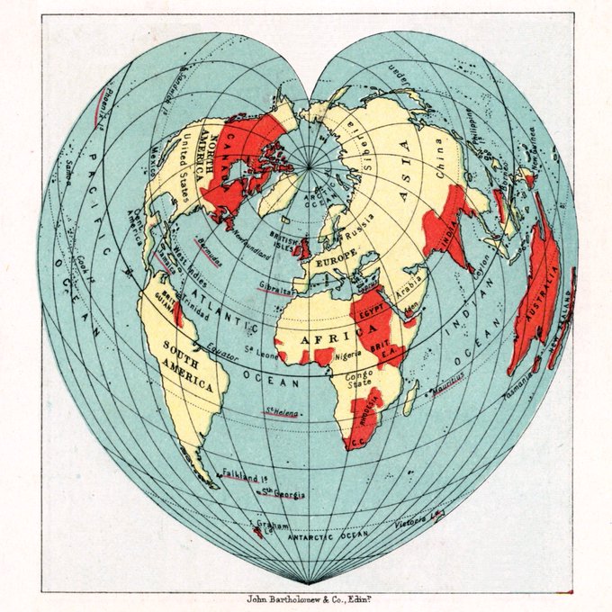
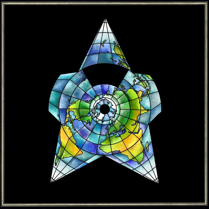
Today only one world view will do...
#cordiform #HappyValentinesDay #ValentinesDay2018

From the Clyde to the Antipodes, from the 18th to 21st century... Find out about recent research involving #maps at this Seminar on 20 April at Kelvin Hall, #Glasgow. Programme & booking form at https://t.co/aaUnmXUk9c


#AdventWorldMap day 23. Happy Christmas Eve Eve! Just one more map to share with you: a beautiful star chart from an 1801 celestial atlas by Bode. He depicted more than 100 constellations, compared with 88 officially recognized today ✨
https://t.co/uK8qhytLFs
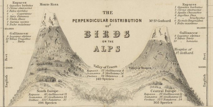


With Floe’s visit from @natlibscot, thoughts turned to our feathered friends. Another of Johnston’s 1848 zoological maps fills that European gap in our #AdventWorldMap. Love this diagram of #birds of the Alps (but Floe was more intrigued by the penguin)
https://t.co/o1OBsEbcIz