
Randy Olsonさんのイラストまとめ
@randal_olsonFollow @randal_olsonさんをフォローする
フォロー数:27921 フォロワー数:110069

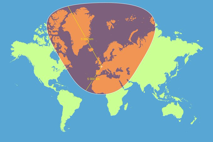
A circle with a 5000km radius centered on Paris with a Mercator projection. #dataviz
Source: https://t.co/RbpvTilzFJ
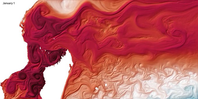
One year of sea surface temperature in the southwestern Indian Ocean. #dataviz
Source: https://t.co/8wQjYqXc6J

Global map of forest height made using @NASA satellites. #dataviz
https://t.co/7S4SgfoLxp

Coloring #Paris' roads by designation. #dataviz
More cities + #OpenSource code at https://t.co/jUJkMm5uRs

Who needs #music genres when there is data? #dataviz #DataScience
https://t.co/T708SrGTFj
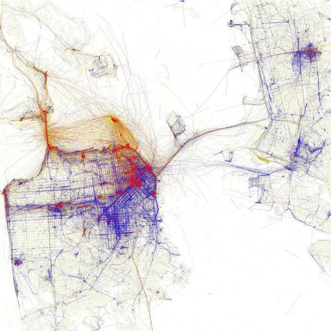
January: Where pics are taken in San Francisco by tourists (red) and locals (blue) #dataviz
https://t.co/w6WsLE7zKR
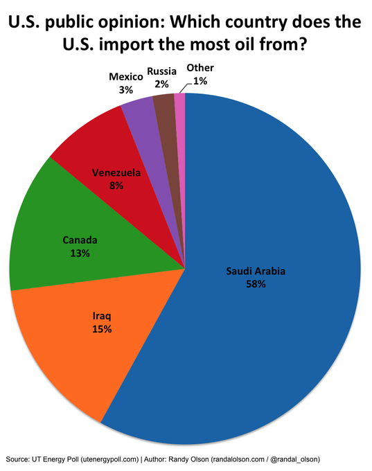
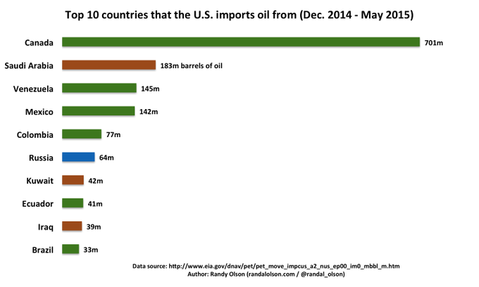

Where the US thinks its oil comes from vs. where it really comes from. #dataviz
http://t.co/clW8HhP1YR

Isochrone Map: Austro-Hungarian Empire Railway Network in 1912: https://t.co/CmQiCMgA11 #dataviz

Popularity of #college degrees over the past 40 years.
Source #dataviz: http://t.co/Z3tk33fymF #education