
terenceさんのイラストまとめ
@researchremoraFollow @researchremoraさんをフォローする
フォロー数:975 フォロワー数:39787


A forest map of Perú using data from 2019.
#rayshader adventures, an #rstats tale
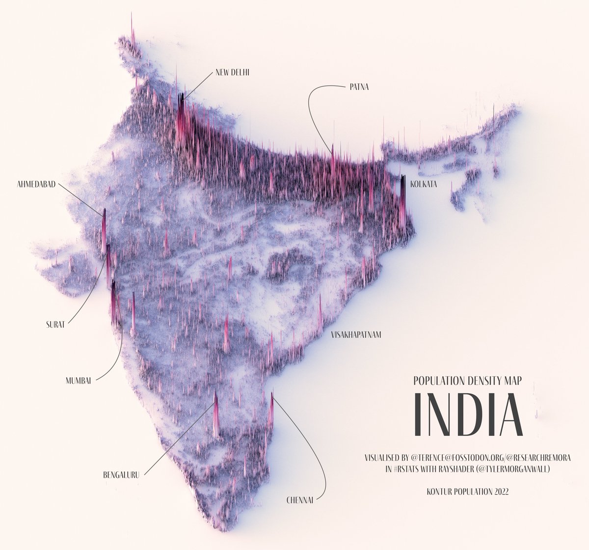
Also had lots of requests for this one: a population density map of India. This was by far the longest render.
Well, except for furry France, which still holds the record.
#rayshader adventures, an #rstats tale


A population density map of the Tōhoku region, which comprises six prefectures: Akita, Aomori, Fukushima, Iwate, Miyagi, and Yamagata. Hope I got all the labels right. 😅
#rayshader adventures, an #rstats tale

In response to a DM, here's a shaded relief map of México! This gives me the opportunity to showcase @paezha's cool package {MexBrewer}, which contains colour palettes inspired by the beautiful works of Mexican muralists.
#rayshader adventures, an #rstats tale

At 592m, here's a shaded relief map of the deepest lake in the United States—Crater Lake. How deep is that? Stack the Eiffel Tower, Washington Monument, and the Statue of Liberty atop one another and we still won't reach the lake's surface.
#rayshader adventures, an #rstats tale

A shaded relief map of Lake Tahoe, California.
#rayshader adventures, an #rstats tale

Why would I, the #rayverse's number one fan, use Python? :P Because I wanted to play with the cool {riverrem} package by @OpenTopography! And it is very cool indeed. What's more, it is fast, faster than if I did this in QGIS.
And I used RStudio of course! Yay {reticulate}!


This was cooking in the oven—a more fitting render of the Red River.
#rayshader adventures, an #rstats tale