
Simon Kuestenmacherさんのイラストまとめ
@simongerman600Follow @simongerman600さんをフォローする
フォロー数:215207 フォロワー数:264446


Bird migration routes from the Arctic refugee towards the South occurs along four major flyways. Source: https://t.co/4bzEciRfl4

Map models potential nuclear fallout across the US in case of such an attack. I for one always loved Oregon... Source: https://t.co/jlt8omNt8v
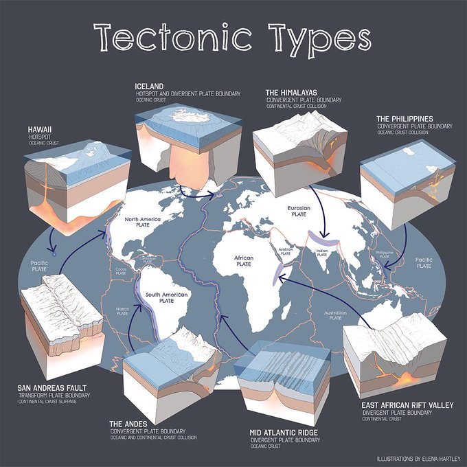
Beautiful infographic teaches us about tectonic features across the globe. I expect @BuzzFeed to produce a "What type of tectonic plate are you?" quiz any minute now... Source: https://t.co/qQ9XMwsnha

“I’ve been sent this lovely chart showing nested synonyms for popular adjectives without a source. Still worth sharing. I love it!” https://t.co/jfbVBkZiuq

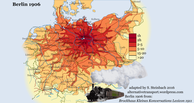
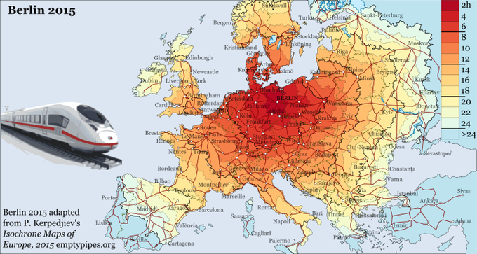
Isochrone map shows travel times from Berlin in 1819 (by coach), 1906 (by steam train) and 2015 (by fast train). Source: https://t.co/xQVPigsPSs

Today I learned that the ripeness level of a banana 🍌 changes the sugar and fiber content of the fruit.

Amazing drawing by @adolfux shows the famous walled city of Kowloon in #HongKong. Source: https://t.co/TwRlSJIcGp

Fairly recently it was discovered that Oceania is a continent in its own right. This overlay map shows just how vast this continent of seafarers really is. Source: https://t.co/JSpJscHz0x

As beautiful as it gets! This French map from 1858 (!) shows global emigration patterns (where do those leaving France move to). Wonderful piece. Source: https://t.co/Pw7dZGUPKf

This post-WWII map shows the main streams and types of transportation. Sourced from this fine Facebook page: https://t.co/immhjy9Yqv