
Simon Cardyさんのイラストまとめ
@weather_kingFollow @weather_kingさんをフォローする
フォロー数:1858 フォロワー数:4079


Latest (night time) satellite imagery from Himawari-8 showing tropical cyclones Veronica and Trevor impacting the NW and NE coasts of Australia.


Fairly strong signals for a high pressure anomaly over the next 15 days, which suggests below average precipitation for large parts of Europe


One of the ensemble models shows a large low pressure anomaly over N Europe in the next 5 days (with frequent wet & windy spells) but then a transition during days 6-10 and 11-15 to a high pressure anomaly over the UK (with settled, calmer weather returning).

the weather map for the remainder of the week shows a large low pressure anomaly across N Europe (bringing frequent wet & windy spells) with a high pressure anomaly to the W of Portugal.


Our resident dome of high pressure, which has been bringing our astonishing late winter weather, will break down as an Atlantic low pressure brings its weather impacts at the weekend. The weather patterns are going to change. Simples.


the astonishing warm spell (with chilly, foggy nights in places) caused by the significant high pressure anomaly will break down as a low pressure anomaly takes over. this will bring frequent windy & wet spells to NW Europe in March.


The astonishingly mild spell set to continue for most of Europe. Maps show expected temperature departures from average.


Astonishing warmth expected across most of Europe over the next 10 days. Maps give an indication of the temperature departures from average.

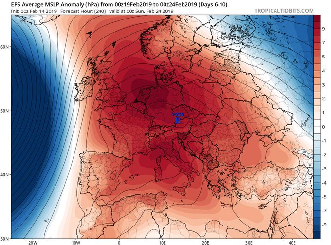
A giant high pressure anomaly over Europe during the next 10 days - this stable weather pattern will generally bring above average temperatures & sunshine with below average rainfall & wind speeds, but some frost & fog in places night/morning.
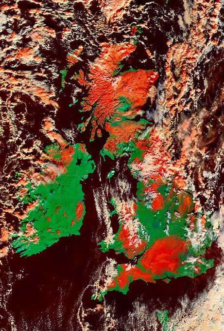
With partly cloudy skies today, NASA satellite can estimate the snow covered ground across the UK & Ireland- shown as red to distinguish from cloud.