geologicのTwitterイラスト検索結果。 221 件中 6ページ目


“Some day, perhaps in the fullness of geologic time, the last crane will trumpet his farewell and spiral skyward from the great marsh....
And then, a silence never to be broken, unless perchance in some far pasture of the Milky Way.”


At the time I forgot to share an interp of the final model from the @natlibscot @CreateInf project. Trained on ~900 imgs of geological surveys from @natlibscotmaps. Smaller dataset than the others, you can see it’s a little nervous.


Geoheritage sites are a natural legacy of all 50 U.S. states & territories. See examples of what state geological surveys are doing to identify and promote geoheritage for the education and enjoyment of the public.
Join our webinar on 10/6 to learn more: https://t.co/Q1BEbq9lLv


#geotweeps, please help!
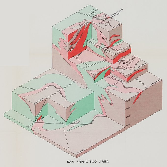
Any simple way to create a geologic-model 3D box with relief and cross-sections / seismic lines?
There seems to be a way to do it with Google SketchUp but seems complicated and I think might be outdated... https://t.co/RrnSPjz1SW


Did you know that a 2013 geological survey conducted by @USGS found that *23* percent of all gently sloping hills in the continental US are actually the remains of dragons?


The 3.168m Monte Permo is the first peak in the #Dolomites to be climbed on September 19, 1857, by Irish alpinist John Ball & a local guide. Geological map from 1934 by pioneering geologist Maria M. Ogilvie Gordon https://t.co/Jcb0YdXzEh
#STEM #science #WomenStem


Peek inside A Slice through America: A Geological Atlas by David Kassel. This unique collection of stratigraphic maps tells a new story of the ground beneath our feet.
https://t.co/wnKM7VWbL9
@ilevelinc #map #stratigraphic #geology


"The beauty of these drawings is matched only by the stories they tell about both deep geological history and the human saga of extraction"—@billmckibben
Introducing A Slice through America by David Kassel, coming this October
https://t.co/UGZRw9SIc1 #map #mapdesign


#HATM #BlackPantherWatchParty
Celestial and geological history provide a way to escape modernism and the Enlightenment, framing a criticism of the social conditions in Oakland with 'James' and N'Jobu.
@HerbertHistory #WakandaSyllabus


@HannahLimtiaco @WhySharksMatter Thank you loved sharks since a young child - was meant to do PhD in Carboniferous sharks in early 80’s but became a geological & children’s non fiction illustrator instead


@carla_citarella @J_MartinezFrias Mi piace molto la menzione di Jesus Martinez delle rocce e delle strutture geologiche che compaiono nel dipinto di Leonardo Da Vinci "Vergine delle Rocce". Secondo il geologo David Bressan, questa formazione geologica è una sequenza sedimentaria che si trova negli Appennini.

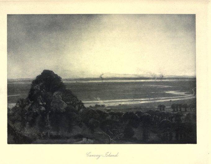
Reading up on the #Geology of #Essex in the 1903 @VCH_London volume. 'The whole aspect of Essex appears geologically to be one of somewhat sluggish repose, despite the constant waste of the ground by rain and rivers and sea.' @Essex_VCH @essexarchive


GeoGreymon
(Geological+Great)
Dinosaur
Attacks:
Mega Flame
Mega Burst
Horn Impulse


#Mars
The Radar Imager for Mars' subsurface experiment (RIMFAX) is a ground-penetrating radar on @NASAPersevere. It uses radar waves to see geologic features under the surface, and can make detections perhaps dozens of meters/yards underneath the ground.

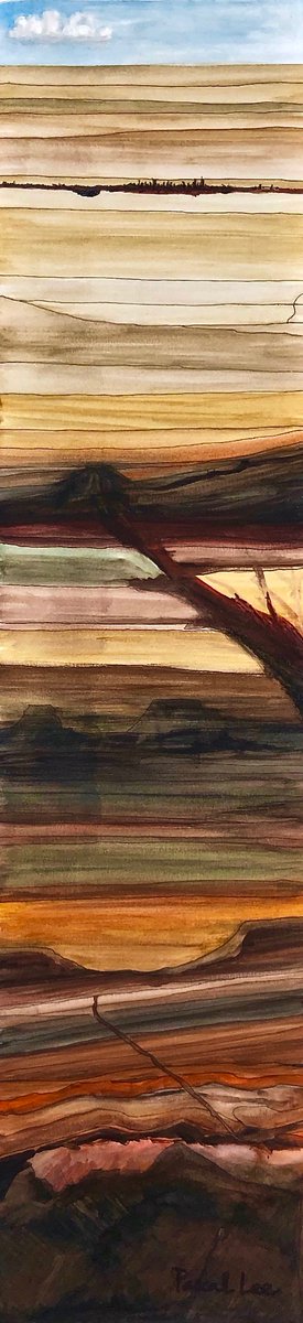
THE ANTHROPOCENE - And Its Relationship To Other Geologic Units. (Watercolor & ink,7x29in,2020)
How long will our civilization last? Just back from a future where what was left of us was merely a thin layer of mangled rust at depth.
Will try the other spacetime exit next time.

@BenPark65051150 @disabilityarts A cross-section of Furnusite shown in polarised light with nice ornamental relic fractures and dissolved crystals often found in other metamorphic rocks containing fructozene
#Metaordinary #GeologicMetaphoric
#DigitalArt #CovidCommissions


@dyslxicRant @disabilityarts A cross-section of Prandiumite shown in polarised light with nice ornamental relic fractures often found in other metamorphic rocks containing solanacium
#Metaordinary #GeologicMetaphoric
#DigitalArt #CovidCommissions

A cross-section of derived & worn spherical fossils taken from a sediment of Corvidian age (shown in polarised light) showing relic ornamental structures - signs of life from a #PreCorvidian era
#Metaordinary #GeologicMetaphoric
#DigitalArt #CovidCommissions
@disabilityarts

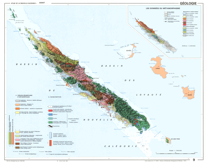
⛰️ 3D style geological map of New Caledonia (Kanaky) 🇳🇨
🗺️ "Nouvelle Calédonie - Géologie. 1:1000000. 1981"
🛠️ Made with #Aerialod , @qgis and @GIMP_Official