GOES16のTwitterイラスト検索結果。 7 件


Before/during the #RollingFork/#SilverCity Mississippi #EF4 tornado, pulsing cold overshooting tops were seen in 1-minute @NOAASatellites #GOES16/#GOESeast Infrared images - with a notable #GLM #lightning jump just before the event: https://t.co/vDlVABynZ1 @NWSJacksonMS #MSwx


米国海洋大気局NOAAとNASAが共同運用する気象衛星GOES16号(-R)試し描き。
大西洋上の16号と太平洋上の同型の17号(-S)が運用中。太陽電池パドルなどに宇宙天気観測機器も装備。
下手絵は人物が地球を観測するときに北が上になる配置で。
公式サイト(画像も)→https://t.co/Q18T6t8MqR

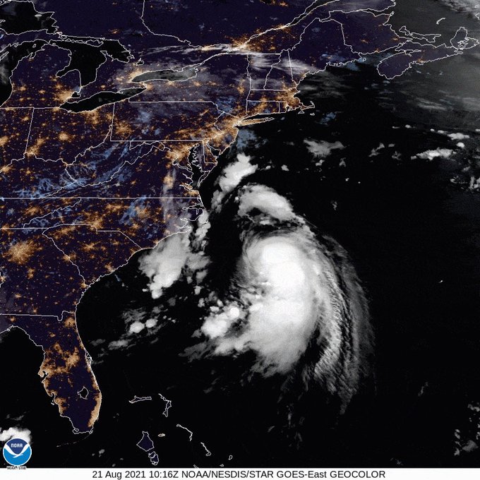
TROPICAL UPDATE: #Henri is now a Category-1 #hurricane, with sustained winds of 75 mph. @NOAA's #GOES16🛰️ is tracking it very closely as #Hurricane and #StormSurge Warnings continue for parts of New York and New England. More: https://t.co/oMuv0n3iSc

TROPICAL UPDATE: In this infrared/visible satellite composite, @NOAA's #GOES16🛰️ zoomed in on Cat. 4 #HurricaneDelta moving closer to the Yucatan. #Delta's winds are now 145 mph and strengthening is possible despite it not having a well-defined eye. More: https://t.co/VTAp4gGkHs


25/06/2020
09:25 horas
Imagen GeoColor (#GOES16) de esta mañana de jueves, mostrando la tonalidad del Polvo de Sahara (#SAL) sobre la Península de Yucatán y parte del Golfo de México. Las lluvias en el oriente del país y oeste del mismo Golfo han limitado su paso a Veracruz.


Kelvin–Helmholtz waves in the #GreatLakes showing up nicely in the 6.19µm #watervapor from preliminary/non-operational #GOES16 this morning.