hwrfのTwitterイラスト検索結果。 22 件


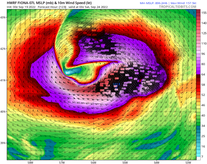
The latest (12Z) HWRF and HMON runs show an absolutely RIDICULOUSLY intense post-tropical hurricane #FIONA hitting #NovaScotia on Saturday at 6 AM.
914 mbar? That would be the strongest landfalling extratropical storm anywhere in the WORLD. #NSStorm #PEStorm #NLwx


The 00z HWRF has #Fiona as a Category 3 major hurricane directly over Sable Island, Nova Scotia on Saturday morning. https://t.co/wPEvfjvF9A


Fresh HWRF run...similar to GFS with #Henri as a tropical storm near Block Island Sunday afternoon


#Elsa is now a hurricane, having undergone borderline rapid intensification in the last 24 hrs despite moving at 25 kts & facing ~20 kts of shear. Certainly didn't see this coming!
It's also concerning to see some of the really aggressive HWRF runs from yesterday verifying 😬 https://t.co/60kmoAD3A0


HWRF isn't letting go of the potential for a severe hurricane to impact the Caribbean around Independence Day


Latest HWRF just out for Hurricane Zeta:
Showing 85kt at landfall near New Orleans, right in line with the latest NHC forecast. Still expect it will be a Cat 2 at landfall, but it's good to prepare for a borderline Cat 3 given #2020

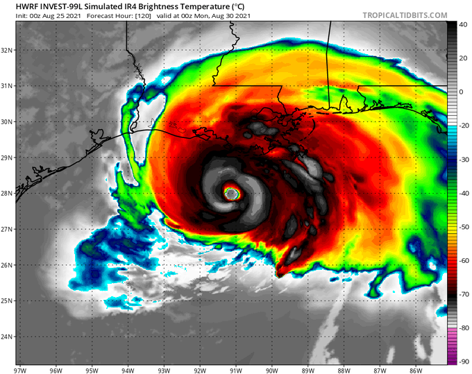
In exactly three days from now, here's what the HWRF model says a Hurricane Laura could look like as it's approaching the Gulf Coast.
I'll say it very simply: Laura poses a potentially catastrophic threat to the Texas and Louisiana coast.
Watch this storm very closely.


12Z update on #Bavi, now a typhoon at 70 knots. 72 hr forecasts from #ECMWF and #HWRF are showing
super #typhoonBavi making landfall in North Korea, South Korea, or just west of North Korea border with China. Must continue to monitor this historic storm.


06Z HWRFのFT87で知床半島でものすごいフェーン現象が計算されてるんだけど、モデルの問題なのか、環境場がこの通りになれば本当にこうなるのか、どっちなんだろう
(2枚目以降は北緯44.1度の鉛直断面)


Won’t lie, the HWRF did a fairly good job at forecasting this convection burst, in fact, it looks almost like a spitting image tho smaller. Let’s see how it performs on the rest of the night.


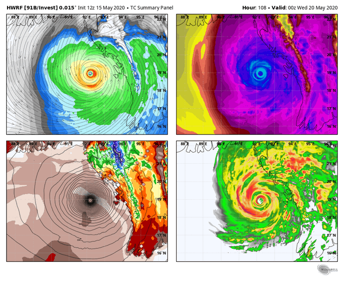
The 12z HWRF takes Invest 91B in the Bay of Bengal and intensifies into a solid category 5 cyclone with a pressure near 900mb by next Wednesday. A lot of potential with this one given the very warm water temps.


