
NLS Map Collectionsさんのイラストまとめ
@natlibscotmapsFollow @natlibscotmapsさんをフォローする
フォロー数:1034 フォロワー数:14011

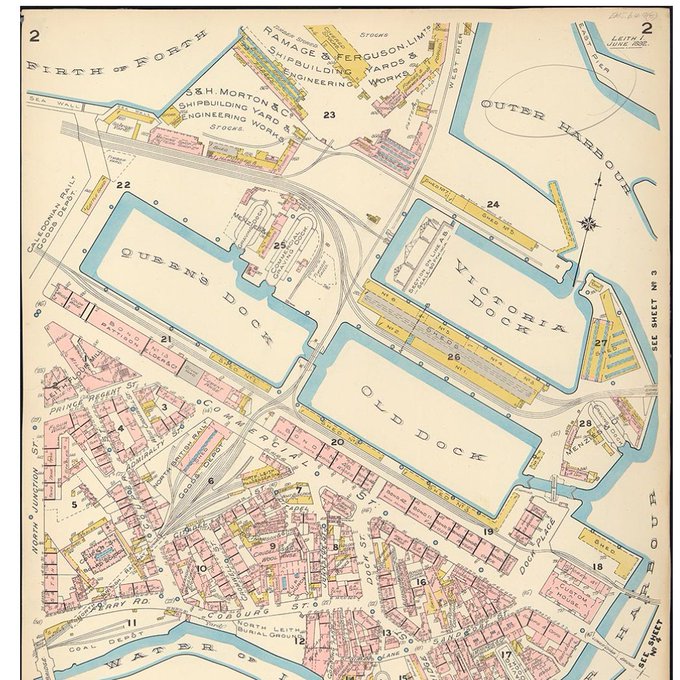

We're exploring the bustle of Leith Docks in the 1890s today, courtesy of Charles Goad's Insurance Plan of Leith. https://t.co/FQImW3QMqG

It's still #WaterDay... fancy a dip? Check out the Bathymetrical Survey of the Fresh-Water Lochs of Scotland, 1897-1909, the first comprehensive examination of the depths and nature of 562 inland Scottish lochs:
https://t.co/mGrL7n6qRB
#Scotland #Water


Which #mapmonster do you identify with this Monday morning?
Monsters can be found in Ptolemy's Atlas and Janszoon's coastal chart (and your office?):
https://t.co/KlWfKp2mJ9
https://t.co/KePRgqkBeS
Thanks for the inspo @natlibscot 😉

@peadairbeag We have several historic geological maps of Scotland in our collection, and you can view a selection on our website https://t.co/2cO75EVdPI. Archibald Geikie's 1876 map https://t.co/LfeeZvPnEQ would be contemporary with the map of Ireland by Griffiths and Jukes.

We love 😍the gorgeous views of Corra Linn and the Fall of Foyer shown on John Thomson's comparative view of the rivers of Scotland, 1832. W is for #Waterfall in #ArchiveZ. https://t.co/EpwR2mbA6X

@running_past @NorthCrayMal We agree the 1st edition 25-inch to the mile coloured @OrdnanceSurvey maps are gorgeous😄. View sheets for Scotland https://t.co/x61pQymmrj and England and Wales https://t.co/mg4ZrQeNAY on our maps website, though we don't hold copies of every edition for England and Wales.
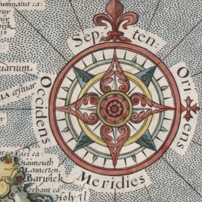


Our final ‘C’ for #ArchiveZ is COMPASS ROSE.
Found on many early #maps/#charts, they show north, south, east, west and intermediate points. They can also be very beautiful!
We’ve made one for #colouring in 😀Download a PDF >
https://t.co/E1ceCE8EVz
Enjoy!
#FridayFun

We're loving 💕 this beautiful drawing of pansy flowers, decorating the title of an 18th century Lanarkshire estate plan. https://t.co/rzsOIbnSev
#maps #NationalGardeningWeek #Lanarkshire
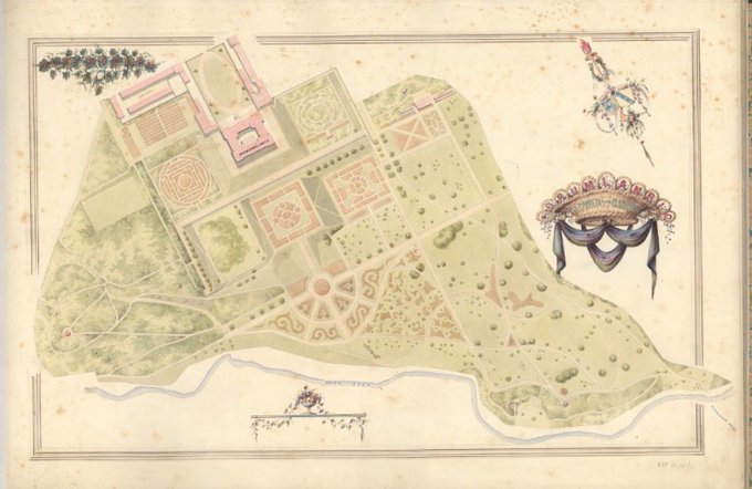
Day 3 of #Archive30 is #ArchivePath
Join us for a wander in Drumlanrig Flower Garden, with this gorgeous manuscript plan of 1848.
https://t.co/be3zwFReu7 #maps #Drumlanrig

Happy #InternationalBagpipeDay everyone!
Philp's Comic Map of Scotland (1882) nicely blending #cartography and #caricature.
https://t.co/zl4Aa0H9Nu
#scotland #maps #bagpipes