
Simon Kuestenmacherさんのイラストまとめ
@simongerman600Follow @simongerman600さんをフォローする
フォロー数:215207 フォロワー数:264446


Maps show Berlin in 1440 and 600 years later in 2021. It's great fun to see what's still around and easily visible like the Gertraudenbrücke or the Nikolaikirche.
Old map: https://t.co/OWaeDyx4K5
GoogleMaps view of today: https://t.co/dDHLw4ntrN

Historical clan map of Medieval Scotland. Are you even a real family if you don't have a family crest? Source: https://t.co/rfRzuPdfYK

Map shows the global distribution of snakes 🐍 this includes sea snakes too. No snakes in Ireland and NZ. Source: https://t.co/R6jbNpZoKX

This map is more interesting than I first thought. It’s a minimalist take on the US and shows a simplified average colour pattern across the nation based on satellite images. Source: https://t.co/QMgyqw9tEh

The year 2019 in satellite images (cloud cover removed). A stunning perspective of our lovely planet. Source: https://t.co/a8Fk7IXrpB

Yawn. This almost put me to sleep. Map shows nothing but the world's one billion sheep. #badgeographyjoke Source: https://t.co/PA2YZW6wYv

Lovely map shows the agricultural production of Spain. I always liked those touristy picturesque maps... Source: https://t.co/vQx3C93jfN
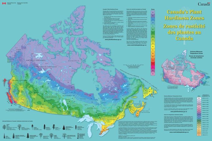
If you only knew Canada's Plant Hardiness Zones you’d probably still guess where most Canadians live. Source: https://t.co/dBLNdPYS9o

Wonderful map by Miguel Valenzuela shows the Mediterranean seafloor. Source: https://t.co/QYBWWvN7ak (If you are looking for a gift you can buy his prints on @Etsy - the Swiss one is great for example: https://t.co/gMPEH5qhLd)
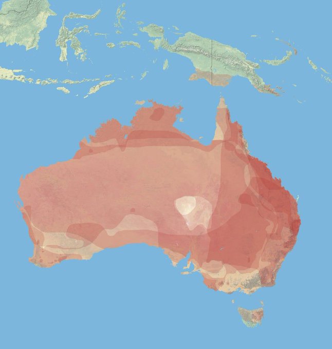
Map shows the macropus species density across Australia. Macropus is essentially a fancy word for kangaroo.
Map source: https://t.co/Yi47qYJC71
Wikipedia on macropus: https://t.co/x2dSHlZ00f