
Simon Kuestenmacherさんのイラストまとめ
@simongerman600Follow @simongerman600さんをフォローする
フォロー数:215207 フォロワー数:264446


Visual by @davidmasp the biomass distribution of the animal kingdom. Source: https://t.co/UhMiBGPReO

If you only like the red bits of flags you will love this map of Europe. It only shows the red bits of the national flags (excluding Coat of Arms and Eagles). Now you know. Source: https://t.co/v4DJ55tcEM
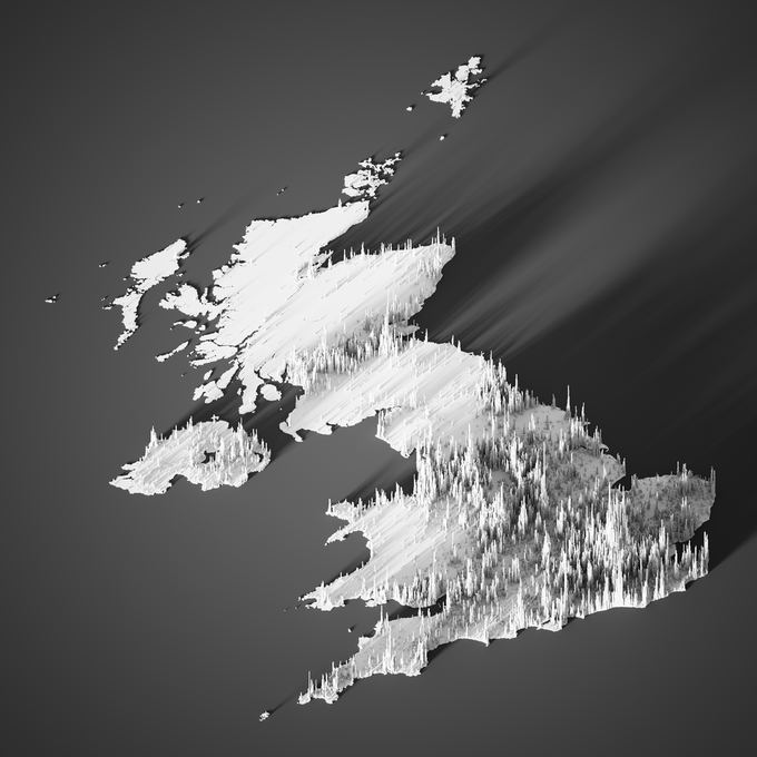
Really cool map shows the UK population as of 2020. Source: https://t.co/bitVVCRGXZ

This 1558 map is arguably the first map showing the Americas in its entirety. First time the phrase Mare Pacificum was used. Japan (Zipangri) moved very close to Mexico. The big ship is the Victoria, the only surviving ship of Magellan’s voyage. Source: https://t.co/DzeLjyG5zK
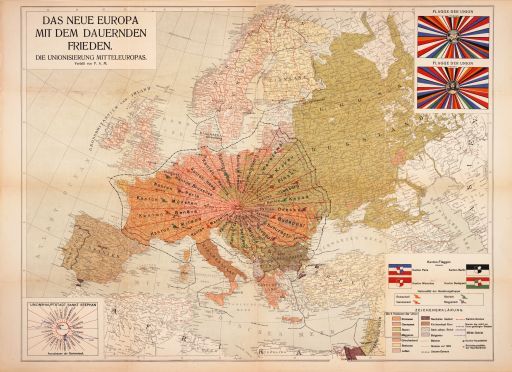

100 years ago this bizarre version of Europe was proposed by Austrian P.A. Maas as an attempt to create permanent peace in Europe by getting rid of traditional nation states. It's so mad it hurts my brain. Source: https://t.co/ETfP9vbbSD

This emoji cloud was built from 128.5k tweets that referred to "Halloween". Source: https://t.co/vMzqXgo6wW

This map is from the vault of @nytimes and visualises mobile phone connections as of 2011. The geographical patterns that emerge are interesting to view and of course don't correspond with state borders. Source: https://t.co/LCmvdCVloY

Amazing map by Richard Edes Harrison from 1942 allows us to view the world as if we looked at a globe. Go to the high-res version in the source to read the text explaining what we see and where the naval bases are. Awesome piece. Source: https://t.co/iikRMAHWfC

"Canakkale 18 Mart 1915." When reading history I always have to look at maps to make sense of what's happening and to make it all more real. Here we see the Gallipoli peninsula on the Dardanelles Strait. A gateway to the Gallipoli WWI battlefields. Source: https://t.co/10whqPu0Mr

Another great piece of work by @John_M_Nelson. Rotating an old atlas page was easy enough. In the digital age rotating this lovely old map (view from top of My Washington) via scrolling is easier.
Blog: https://t.co/YfrIB3j7CX
Rotate the map yourself: https://t.co/FSVbPsyKd5