CstormのTwitterイラスト検索結果。 53 件


Lilacstorm (Warriors OC)
#artwt #arttwt #warriorcats


“NO ITS FINE”
Man. We really have not touched a lot on our mark and Cesar song have we?
Man.
Anyways here’s the sprites
Art By: CosmicStorm0 (never told me their twitter)
#mandelacatalogue #fnf
@FNFNewsAnnounc1
@News_Funkin


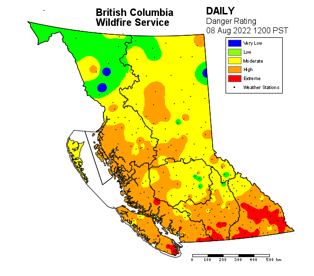
Here we go again! Winter driving on the West Coast explained. #BCStorm

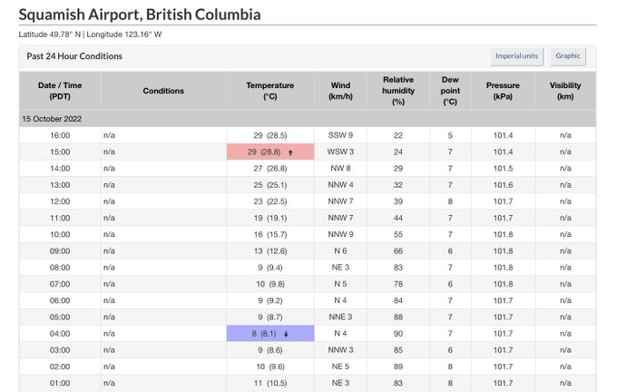

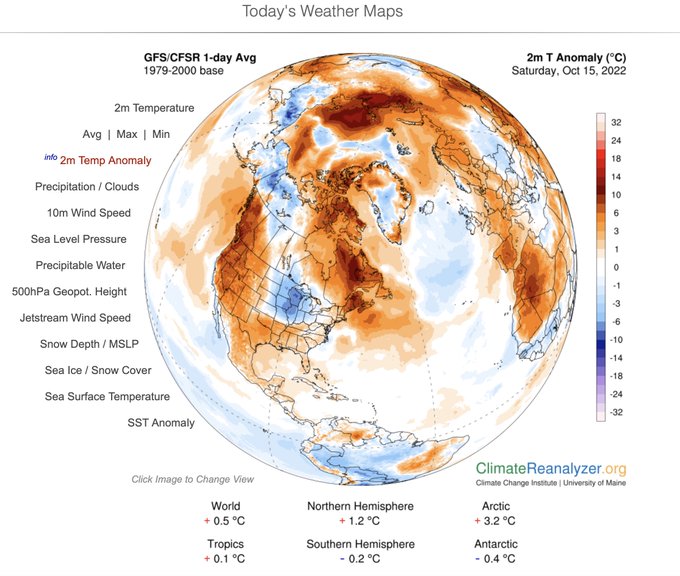
🌡️Exceptional high temperatures for mid-October in #BritishColumbia! 🥵
29.1°C Squamish
28.5°C Abbotsford
28.3°C Hope
28.2°C Agassiz
27.6°C Port Alberni
27.5°C Pitt Meadows
27.4°C Cultus Lake
25.8°C Port Mellon
25.6°C North Cowichan
25.4°C Callaghan Valley [884 m]
#BCstorm 1/2


this ship is pretty neat
#jett #viper #toxicstorm #ValorantArt #VALORANT


【毎日ちょこっと弾き語り 99日目】
melodic storm/ストレイテナー
弾き語ってみた。
明日でついに100日。
頑張ります。
#毎日ちょこっと弾き語り
#ストレイテナー
#melodicstorm
#弾き語りさんと繋がりたい


Some more artfight attacks!
💕1. Bubblegum - belongs to remy
🌸2. pride worm - belongs to AutumnBun
💜3. Selena - belongs to Mysticstormflyete
🌱4. Travis - belongs to GhouliePNG


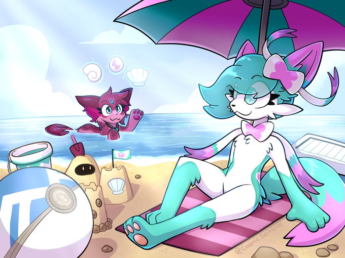
Kirby Storm - Concept art [Inspired by #SonicStorm]
#kirby #kirbyfanart

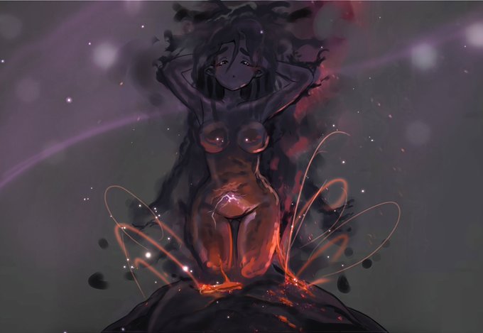

I present u a "little" volcanic storm waifu
#animegirls #anime #volcan #storm #volcanicstorm #drawing #Dessindujour #dessin


As the upper low over the coast & upper low over Alberta shift away from BC, the widespread rain & high elevation snow in the Interior from the AB low will gradually fizzle out through the AM-early aft as a weak ridge builds & the AB SFC + upper low move further east. #BCStorm

Here's a few prizes for the Art raffle I did for reaching 1000 Watchers on DA.
1st place - For Mysticstormflyete On DA
#Art #Furry #Anthro #pokemon #Eeveelution
(This is the 3rd time I've tried to post this, because I keep forgetting to attach the image lol)

Trans-Pacific moisture is headed toward British Columbia Canada and the U.S. states of Washington and Oregon this weekend. #GOESWest water vapor is tracking the impressive flow as it feeds into a Low pressure storm system. Updates at https://t.co/0L306T3BBa #BCstorm #WAwx #ORwx


Small doodle of one of my OCs! Arcticstorm!! :D she has big dreams
#warriorcats