is tracking an impressive flow of atmospheric moisture combining with a Low pressure trough and cold front to deliver wet weather to the U.S. Pacific Northwest and BC Canada into the weekend.

25 55

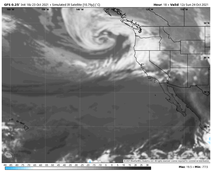
Trans-Pacific moisture is headed toward British Columbia Canada and the U.S. states of Washington and Oregon this weekend. water vapor is tracking the impressive flow as it feeds into a Low pressure storm system. Updates at https://t.co/0L306T3BBa

16 52

Winter about to roar back into the PNW, Potential for 3-4 feet of snow in the OR and WA Cascades over 4,000ft during the next week. Snow levels reaching possibly as low as 1000ft on Thursday-Friday (no snow expected in the valley)

3 20

This future bomb cyclone is going to be astounding. It's likely to go under a warm seclusion as it rapidly deepens. Hurricane-force winds are expected but thankfully well offshore but the waves will be large & dangerous. 50ft+ waves are expected.

32 77

Hard to imagine a more beautiful sight after a summer of brutal heat, drought, and fire in the West.

A powerful Atmospheric River stretching the width of the Pacific is bringing heavy rain & mountain snow to and likely putting an end to fire season there.

61 281

A dangerous and potentially historic heatwave is forecast across the Pacific Northwest 🇺🇸 and British Columbia 🇨🇦 this weekend and early next week.

Temperatures are likely to exceed 100°F/38°C in places, which is a whopping 30-40°F/20-25°C above normal 🔥

26 35

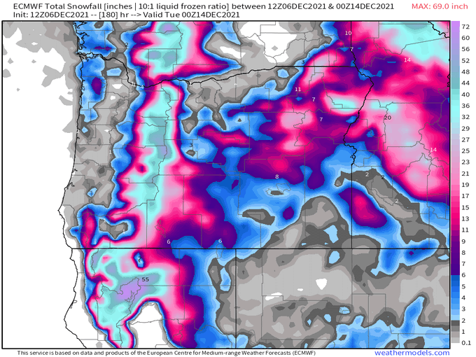
Available moisture looks to approach 200% of normal this weekend as an atmospheric river impacts the Pacific Northwest. Steadiest rain Saturday night through Sunday. Humid on Sunday, too

10 20

A penumbral lunar eclipse will be visible just after sunset on July 4th with maximum eclipse around 10:30pm MDT. https://t.co/fRQGOXTCTL

29 59

Smoke from is being transported as far north as today.

43 44